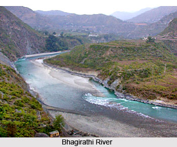
 History of Uttarkashi District dates back to ancient times, to the ages of Mahabharata. This region was inhabited by hill tribes since ancient times. The hill tribes namely Kiratas, Uttara Kurus, Khasas, Tanganas, Kunindas and Pratanganas find references in the Upayana Parva of Mahabharata. The land of Uttarkashi District has been held sacred by Indians since ages where the seers and sages had found solace and spiritual aspirations and performed penances and where Vedic language was better known and spoken than elsewhere. People came here for learning Vedic language and speech. According to an account given in the Mahabharata, Jada Bharata a great sage performed penances at Uttarkashi. The Kedar Khand of Skanda Purana refers Uttarkashi and Bhagirathi River, Jahnavi and Bheel Ganga.
Uttarkashi`s ancient name was Barahat, which can be loosely translated into `large market`, indicating that it was probably a prosperous market town in the past. Possibly, this was the main market town for trade between India and Tibet. Scholars maintain that the name Barahat comes from the ancient Trishul, which is supposed to be the source of barah shakti (12 powers), and that Barahat is a corruption of the word `Barah`.
According to history of this region the district of Uttarkashi was part of Panwar rajas` territory. The founder of Pal or Panwar dynasty was Kanak Pal, who came to Uttarakhand in 9th century AD, possibly from Maharashtra. He married the daughter of Bhanu Pratap, a chieftain of Chandpur Garhi, and thus himself became the chieftain at this fortress town. It was Raja Ajay Pal, Kanak Pal`s 37th descendant, who established the supremacy of the Panwars after defeating the 52 chieftains who existed in Garhwal, in the early 16th century AD. He shifted from Chandpur Garhi first to Dewalgarh and then to his new capital, Srinagar. In the mean time, the rulers of Garhwal consolidated the power and size of their kingdom. In fact, Garhwal was an independent kingdom on which the mighty Mughals of Delhi had neither influence nor supremacy. The suffix `Pal` was changed to `Shah` some time in 17th century AD.
Further, history of Uttarkashi District also suggests that the district was part of Garhwal Kingdom ruled by Garhwal dynasty that carried the cognomen `Pal` which was changed to Shah during 15th century conferred by Sultan of Delhi perhaps Bahlul Lodi. In 1803 Gorkhas of Nepal invaded Garhwal and Amar Singh Thapa was made Governor of this region. The Gorkhas came into contact with the British power in 1814. The border troubles prompted the British rulers to invade Garhwal. In April, 1815 Gorkhas were ousted from Garhwal region and Garhwal was annexed as British district and was split up into eastern and western Garhwal. The eastern Garhwal was retained by the British Government. The western Garhwal, lying to the west of the Alaknanda River with the exception of the Dun was made over to the heir of Garhwal dynasty Sudarshan Shah. This state came to be known as Tehri Garhwal and it was merged with the state of Uttar Pradesh in 1949 after India attained independence in 1947.
After independence of the country, when the kingdom of Tehri Garhwal merged with India, Uttarkashi was made a border district in the year 1960. The new district acquired importance because of the two very significant pilgrimage centres within it: Gangotri and Yamunotri, the sources of the two holy rivers, Ganga (Bhagirathi) River and Yamuna River.


