 History of Powai Lake dates back to the year 1891 when it was constructed. Before its construction by the British, the estate where the lake is located was leased to Dr. Scott on a yearly rent in 1799. After his demise in 1816, the control of the estate was took over by the government in 1826. The government then leased it to the then vice-president of the Agricultural and Horticultural Society of Western India, Framaji Kavasji. In 1891, a stream tributary of the Mithi River was dammed which served the water needs of Powai village during the British rule. Initially work was also done for augmenting the water supply to Bombay (now Mumbai). Two dams of 10 metres were constructed then for storing rain water flowing from the lower slopes of the Western Ghats along with the streams from the eastern and north eastern slopes of hills.
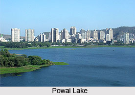
Construction of Powai Lake
The building of Powai Lake was planned towards the southeast of a much larger lake called Vihar Lake, as a part of antiwater famine measures as well as for supplying water to the city of Mumbai. In the year 1889 the construction work began as per the scheme. The construction was completed soon with an initial cost of more than 6,50,000, rupees, following which it began providing around two million gallons of water per day. However the quality of water was hugely criticized after which it was abandoned.
Later Developments in Powai Lake
The objective of drinking water supply by Powai Lake was abandoned in the early 1890s. The quality of water was quite poor owing to pollution, large silt deposit, untreated sewage and presence of water hyacinth and weeds. Following this, the lake was leased to a quasi government organisation called the Western India Fishing Association. The organization then began using it for fish culture and angling. In the year 1919, the scheme consumed five lakhs of rupees more in a futile attempt of restoring the supply for at least the suburbs. However with the development of the Tansa dam works, this attempt was also given up.
Restoration Works in Powai Lake
Later in the year 1936 the Bombay Presidency Angling Association was established. It was registered as the Maharashtra State Angling Association (MSAA) in the year 1955 under the Societies Registration Act 1860. Presently the lake is under the control of this organization. In view of the severe environmental pollution, the constitution of the MSAA has been revised for actively taking care, cleaning, developing, maintaining and beautifying the environment of Powai Lake. Currently the key responsibilities of MSAA include water quality analysis, supporting research with Fisheries Department for conservation of the Indian Mahseer, removal of water hyacinth infestation and augmenting security.
History of Powai Lake
History of Powai Lake can be traced back to the year 1891 when it was built for supplying drinking water to Mumbai city. However poor water quality turned it to a site of fishing and recreation.