
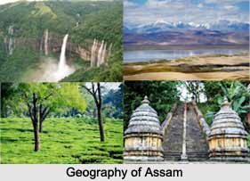
 Assam comprises an area of 78,523 square kilometers (30,318 square miles). Assam is composed of plains and river valleys. It can be divided into three principal geographical regions: the Brahmaputra River Valley in the north, the Barak Plain in the south, and the Mikir and Cachar Hills that divide the two regions. The Brahmaputra Valley is the dominant feature of Assam. It enters Assam at the extreme northeast corner and runs westward (nearly 450 miles) before turning south to enter the plains of Bangladesh. The river valley is studded with hills and ridges. The valley is surrounded on all sides except the West by mountains.
Assam lies beneath the foothills of the Eastern Himalayas and is bounded on the north by Bhutan and to the east by Arunachal Pradesh, Nagaland, and Manipur, to the south by Mizoram and Meghalaya and to the west by Bangladesh and Tripura. The capital of Assam is Dispur. A ring of blue hills surrounds Assam and it has the two valleys, the Brahmaputra and Barak Valley. In ancient times Assam was known as Kamrupa, where the Hindu God of love Kama Deva was reborn. The state capital of Assam, Guwahati was the capital of Kamrup.
Climate of Assam
Assam does not have the normal Indian hot, dry season. The temperature of Assam is moderate, about 84 degrees F in the hottest month of August. The average temperature in January is 61 degrees F. In this season there is heavy fog and bristles. Sometimes the rain occurs during March. From June onwards there will be Monsoon winds. Rainfall is highest in Assam. Annual rainfall varies from 70 inches in the west and 120 inches per year in the east. The heavy rain usually results in destructive floods. Twenty percent of Assam`s total area is covered with forest. Deers, elephants, Royal Bengal tigers and wild pigs inhabit the forests. The important forest products are lac, timber, bamboo and firewood.
This article is a stub. You can enrich by adding more information to it. Send your Write Up to content@indianetzone.com









