 Bagepalli is a panchayat town situated in the Kolar district in the state of Karnataka in India. The Kolar district has its headquarters in the town of Kolar. Kolar is commonly known as the golden land of India, because it harbours the renowned Kolar Gold Fields where India`s first gold mining was undertaken during modern times.
Bagepalli is located 100 kms to the north of Bangalore on the Bangalore- Hyderabad National Highway. The exact location of Bagepalli is 13.78 degree North and 77.79 degree East. It has a mean elevation of 707 metres (2319 feet). The area is just beneath the southern border of the Rayalaseema desert belt in the state of Andhra Pradesh in South India.
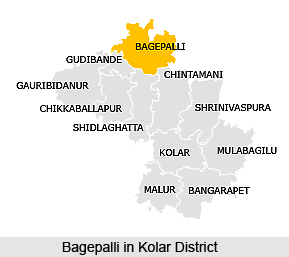
Bagepalli covers an area of 8,225 square kms. Kolar district is positioned in the southern region of the State of Karnataka and happens to be the eastern most district of the state. The district is surrounded on the west by the districts of Bangalore and Tumkur District and by some districts of the adjacent States of Andhra Pradesh and Tamil Nadu on all other sides. It is bordered by the Anantapur district on the north, by the Chittoor district of Andhra Pradesh on the east and by the districts of Krishnagirii and Vellore of Tamil Nadu on the south.
Though positioned in the Kolar district of Karnataka state, and despite being so close to the fast growing metropolitan area of Bangalore, the region shares the same language, culture and social structure with the southern part of Andhra Pradesh. It is a semi arid, drought prone region with only 560 mm of irregular and spatial rainfall.
The dust brown rocky ground is extremely undulating, with miniature hill ranges and projections that comprise the topography. There are no mineral resources as such. Moreover the layer of soil is very thin and frail. As a natural consequence, less than one- half of the entire land is suitable for cultivation, with the rest occupied by the hills and rock-strewn fields. There is an ancient system of rain-fed tanks each irrigating two to ten hectares of wet land. They can scarcely irrigate 5% of the cropped lands. The low water table is utilized by drilling bore- wells to more than 100 meters depth. During the summer months, usually from April to September every year, when temperatures rise as far as 38 degree Celsius, even these bore- wells dry up.
As a result of the scanty rain, there is just one rain- fed crop a year, whose cultivation time is from late June till December. Groundnuts, cowpea, green gram, jowar, field beans, red gram, maize and castor are cultivated on these dry lands. The general bore-well irrigated crops are mulberry, groundnut, onions and sunflower. Irrigation tanks also help in the cultivation of ragi (golden millet) and a coarse variety of paddy. In every fifth or sixth year there is a drought, followed by famine like conditions. Seasonal migration by those engaged in agriculture is an annual happening during the summer months. These agricultural workers come back every year in the month of June or July to eke out some livelihood from small plots of scattered holdings, far away from the villages and near the hillsides.
According to the 2001 India census, Bagepalli has a population of 20,120. Males and females respectively constitute 52% and 48% of the population. Bagepalli has a mean literacy rate of 63%, greater than the nationwide average of 59.5%. 56% of the male population and 44% of the female population are literate. 12% of the population is children yet to reach six years of age.


