
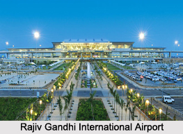
 The state of Telangana is located in the southern part of India. It is spread over an area of about 112,077 square kilometers. This state has historical places, monuments, forts, waterfalls, forests, temples, etc which provide support to tourism here. To experience the beauty of Telangana, tourists can come here utilizing the airways. This state is served by a number of airfields and its primary commercial airport is Rajiv Gandhi International Airport.
Rajiv Gandhi International Airport
Named after Rajiv Gandhi, the former Prime Minister of India, Rajiv Gandhi International Airport is located in Shamshabad, 20 kilometers south of Hyderabad. This public airport is owned and operated by GMR Hyderabad International Airport Ltd. It was opened as a result of a public–private venture in March, 2008. This airport has been provided with one passenger terminal, a cargo terminal, two runways, aviation training facilities, a fuel farm, a solar power plant, etc. As of 2015, this airport was recognized as the 5th busiest airport in India based on its passenger traffic.
Begumpet Airport
 Begumpet Airport is located in Begumpet. Instead of commercial civil operations, this airport is presently being utilized by A.P. Aviation Academy and Rajiv Gandhi Aviation Academy for aviation and flight training. It houses Rajiv Gandhi Aviation Academy and the Begumpet Air Force Station of the Indian Air Force. Begumpet Airport is known to host India`s first civilian air show called `India Aviation`.
Hakimpet Air Force Station
Hakimpet Air Force Station is located 25 kilometers north of Hyderabad. This Indian Air Force base is serving the Training Command of the Indian Air Force. For the training of pilots, necessary infrastructure at the airport comprises of the Fighter Training Wing, Helicopter Training School, No. 43 Equipment Depot and ancillary units. The runway of the airport is aligned east-west and has a length of about 7,384 feet and width of about 150 feet.
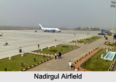
Nadirgul Airfield
Nadirgul Airfield is located 12 km south-east of Hyderabad on the Nagarjuna Sagar Highway. This airfield is owned by Government of India and operated by Airports Authority of India. It serves the Andhra Pradesh Flying Club, Flytech Aviation Academy and the Rajiv Gandhi Aviation Academy for the training of pilots. The airfield has been provided with a pair of parallel runways.
Dundigal Air Force Academy
Dundigal Air Force Academy is located about 43 km from Hyderabad. This military airfield is utilized by the Indian Air Force. It was established in 1969 and started in 1971with the aim to train cadets belonging to different streams at one location. It occupies about 7,000 acres of land.









