 Dindori District is located in the eastern part of Madhya Pradesh. Dindori District is mainly dominated by tribal communities of the state. It covers an area of 571883 hectares with 37.32 percent of the area covered by forests and 41.68 percent as agricultural area. Presently, the tribal population of Dindori district is around 60 percent of the total population and is dominantly rural. Gond tribe, Baiga tribe, Koal, Pradhan, Dhuliya, Bhumia
tribe and Agaria tribe are the main tribes of the region.
Dindori District is located in the eastern part of Madhya Pradesh. Dindori District is mainly dominated by tribal communities of the state. It covers an area of 571883 hectares with 37.32 percent of the area covered by forests and 41.68 percent as agricultural area. Presently, the tribal population of Dindori district is around 60 percent of the total population and is dominantly rural. Gond tribe, Baiga tribe, Koal, Pradhan, Dhuliya, Bhumia
tribe and Agaria tribe are the main tribes of the region.
Location of Dindori District
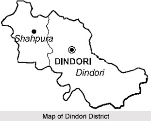
Situated on the bank of the Narmada River, Dindori District is surrounded by the Satpura Mountain range and Jabalpur, Mandla, Shahdol and Umaria district of Madhya Pradesh and Bilaspur District and Kawardha district of Chhattisgarh. It is located at 81 degree 34 minutes longitude and 21 degree 16 minutes latitude. Narmada River passes through the district. Dindori District is situated at a height of 1100 metres above sea level.
History of Dindori District
In the past the region was ruled by the Lodhi and Gond dynasty and during the Gond rule the region was named as Gondwana. District. It was carved out from Mandla District and came into existence in the year 1998. It was created on 25th of May, 1998 with total 927 villages. Dindori District is covered in seven development blocks namely Dindori, Shahpura, Mehandwani, Amarpur, Bajag, Karanjiya and Samnapur.
Economy of Dindori District
The economy of Dindori district depends on forest products and agriculture as the district is covered by mainly Sal and Sagoun trees. Tendu patta, mahlon patta, and char are the small forest products that are collected each year. Both Rabi and Kharif crops are grown in the district.
Tourism in Dindori District
Dindori has many historical as well as spiritual places. Dindori District is significant as a spiritual destination. Laxman Mandva, Kukaramath, Kalchuri Kali Mandir, Mudiakhurd temples are places of great religious significance. The Kanha National Park, Bandhavgarh National Park(Bandhavgarh tiger reserve), Ghughuva National Fossils Park, and Dagona Waterfall are some of the major attractions of Dindori district. Dindori is about 144 kms from Jabalpur.


