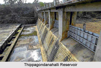
 Thippagondanahalli Reservoir also known as T G Halli Dam or Chamarajsagar, is located at the confluence of the Arkavathy River and Kumudavathi River. It is about 35 km west of Bengaluru.
Thippagondanahalli Reservoir is a man-made reservoir, created by the building of a dam, which was inaugurated in 1933. The total extent of Thippagondanahalli Reservoir catchments is 1453 sq. km and covers parts of Doddaballapur, Nelamangala, Devanahalli, Magadi and Bangalore taluks.
The water body acts as a major source of drinking water for western part of Bengaluru supplying up to 125 MLD. Thippagondanahalli Reservoir is also a popular recreation location, especially during summer months.
However, in recent years, the inflow to Thippagondanahalli Reservoir from the two rivers has been decreasing. The quality of the water has also deteriorated. The study carried out by Indian Space Research Organisation (ISRO) in association with IN-RIMT revealed that there are number of industries in the catchments area, whose effluents along with underground leachate and sewage flow into the Thippagondanahalli Reservoir thus affecting the quality of water.
In addition to this the unplanned development in the catchments area, the increasing urbanization has led to alteration in the drainage pattern of the Thippagondanahalli Reservoir catchments area resulting in reduced inflow into the reservoir.
This article is a stub. You can enrich by adding more information to it. Send your Write Up to content@indianetzone.com


