 Sultanpur District is a part of Faizabad Division of Uttar Pradesh with its administrative headquarters located at Sultanpur. This district lies between 81 degree 32 minutes and 82 degree 41 minutes east longitude and 25 degree 59 minutes and 26 degree 40 minutes north latitude. Sultanpur District is bounded by Faizabad district in the north and Pratapgarh District in the south. In the east its boundary touches Azamgarh District, Ambedkar Nagar District and Jaunpur District and west it touches Barabanki District and Rae Bareli district. Total area occupied by Sultanpur District is 4436 sq kms. The common language of the people of Sultanpur District is the Avadhi dialect of Hindi language.
History of Sultanpur District
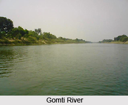
Ancient history of Sultanpur District says that Lord Rama divided his vast kingdom among his brothers and sons. Kusha, son of Rama succeeded to the south Kosala with its capital at Ayodhya. The old city of Sultanpur which lay on the right bank of Gomti River is said to have been called Kusapura or Kusabhavanpur, having been named after Kusha, who is believed to have founded it. Kusha appears to have extended the Aryan ideals and institutions to the Vindhya region.
 A few generations later, in the period of king Para, Ayodhya was occupied by the king Divakara of Shravasti branch, founded by Rama`s second son, Lava. The District then began to be ruled over by the Kosala kings from their capital at Shravasti.
Geography of Sultanpur District
Geography of Sultanpur District mainly comprises plain lands except some regions around Gomti River which drains almost the whole district. However, the southern part of Sultanpur drains towards Sai River flowing through the Pratapgarh District. The climate of Sultanpur District is semi-arid with very hot summer and equally cold winter season. During the summer months from May to June, maximum temperature goes beyond 44 degrees Celsius and in winter months of December to January it is around 4 degree Celsius. The only significant mineral found in the district is Kanker. In fact, it is found in abundance in the region. Moreover, clay is also found in almost in every part of the district.
Administration of Sultanpur District
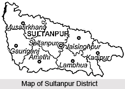
Administration of Sultanpur District consists of six tehsils namely Sadar (Sultanpur), Kadipur, Musafirkhana, Amethi, Gauriganj and newly formed Lambhua. There are 22 development blocks in the district, one municipality and five town areas in the district. Important towns of Sultanpur District are Amethi, Musafirkhana, Dostpur, Kadipur and Koeripur. The district is divided into 26 police stations for the maintenance of law and order.
Sultanpur District is basically agriculture based district as agriculture is the main occupation of the people here.


