 Karnataka Plateau is the region situated at the south of the Deccan Plateau. Interestingly, entire region of Karnataka Plateau except for a small portion is included in the Deccan Lava Region. This plateau region overlooks the coastal plains in the west and the lowlands of Tamil Nadu in the south. The average height of Karnataka Plateau is around 600 metres above the sea level. The eastern part of this plateau region is moderately large in size and low in elevation is known as `Maidan` whereas the western part, which is lying close to the Western Ghats, is known as `Malnad`. The Nilgiri Plateau, which is the meeting point of the Eastern and Western Ghats, rises in the extreme south-west of Karnataka Plateau region. However, it rises abruptly.
As far as the Karnataka Plateau is concerned, Maidan narrows in width in the north. Generally, the broad flat valleys separated by low ridges constitute the characteristic landscape of the northern districts. Climate of this plateau region is specifically mild due to its altitude. Karnataka Plateau being near the equator and the sea has small annual range of temperature. The region receives maximum rainfall generally in between the months of June and September. However, the rainfall decreases progressively towards the east and the rainfall rate is extremely less in the north-eastern districts. The pre-monsoon rainfall is beneficial as it helps the cultivators in breaking soil and for keeping the land ready for sowing at the time when the south-west monsoon rainy season starts. Further, at the Karnataka Plateau region, north-east monsoon also brings a few centimetres of rainfall during the winter months.
Major portion of Karnataka Plateau is falls under the evergreen forests. Sandalwood, bamboo, charcoal, etc. are some of the valuable products of the dense forests of this region. Charcoal is used for smelting iron ore owing to the non-availability of coal in Karnataka Plateau. Paper-mills, plywood and match factories are largely dependent on these forests. The tropical moist forests yield timber and tropical deciduous forests produce teak, sandalwood and bamboo. The eastern portion of Karnataka Plateau being dry has dry scrub type of vegetation.
In the eastern part of plateau region, the soils are basically medium to deep black regur. Deep regur soils are mainly confined to the valleys of the Krishna River and its tributaries. In the western part, it rains heavily during the rainy monsoon season, laterite soils are common. In Maidan, rainfall is uncertain as well as inadequate for unsuccessful crop cultivation. That is why tank irrigation is common in this region. Coffee, cardamom, jowar, maize, cotton, groundnut, etc. are produced heavily in Karnataka Plateau.
In the absence of coal, Karnataka Plateau has developed hydro-electric power for industrial and domestic uses. Further, availability of cheap electric power has enhanced the modern industrial development in the region.
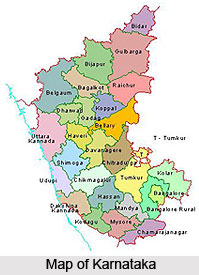
Karnataka Plateau
Karnataka Plateau lies at the southern end of the Deccan Plateau. Climate of this plateau region is moderately mild and warm. Several crops are cultivated at Karnataka Plateau region.


