


 Indian Water Bodies include about 14,500 km of inland navigable waterways. Rivers form a significant part of the Indian Water Bodies. 12 of India's rivers are classified as major, with the total catchment area of over 2,528,000 square kilometers. All major rivers of India originate from one of the 3 main group of watersheds, namely the Himalaya and the Karakoram ranges in northern India, Vindhya and Satpura ranges in central India and Sahyadri or Western Ghats in western India. Apart from rivers, Indian Water Bodies also exist in the form of lakes, estuaries, gulfs, straits, etc. Given below are some of the Indian Water Bodies. Indian Water Bodies include about 14,500 km of inland navigable waterways. Rivers form a significant part of the Indian Water Bodies. 12 of India's rivers are classified as major, with the total catchment area of over 2,528,000 square kilometers. All major rivers of India originate from one of the 3 main group of watersheds, namely the Himalaya and the Karakoram ranges in northern India, Vindhya and Satpura ranges in central India and Sahyadri or Western Ghats in western India. Apart from rivers, Indian Water Bodies also exist in the form of lakes, estuaries, gulfs, straits, etc. Given below are some of the Indian Water Bodies.
Himalayan River Networks Himalayan River Networks are snow-fed and flow throughout the year and create most of the Indian Water Bodies. The other two networks creating Indian Water Bodies are dependent on the monsoons and shrink into rivulets during the dry season. The Himalayan Rivers that flow westward into Pakistan are the Indus, Beas, Chenab, Ravi, Sutlej and Jhelum. 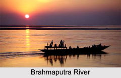
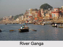
Ganga-Brahmaputra-Meghana System Ganga-Brahmaputra-Meghana System has a principal catchment area of about 1,100,000 square kilometers. The Ganga starts from the Gangotri Glacier in Uttarakhand and is one of the major Indian Water Bodies. It flows southeast, draining into the Bay of Bengal. The Yamuna and Gomti rivers also arise in the western Himalayas and join the Ganga in the plains. The Brahmaputra, another tributary of the Ganga, originates in Tibet and enters India through the far-eastern state of Arunachal Pradesh. It proceeds westwards, unifying with the Ganga in Bangladesh. The Chambal, another tributary of the Ganga begins from the Vindhya-Satpura watershed. The river flows towards the east. Westward-flowing rivers from this watershed are the Narmada and Tapti, which drain into the Arabian Sea in Gujarat. The Indian Water Bodies that flow from east to west constitutes 10 percent of the total outflow. Deccan Rivers 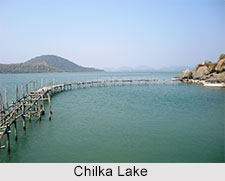 The Western Ghats are the source of all Deccan Rivers, which include the Mahanadi River through the Mahanadi River Delta , Godavari River, Krishna River and Kaveri River. All these rivers pour into the Bay of Bengal. These rivers constitute 20 percent of India's total outflow. The heavy southwest monsoon rains cause the Brahmaputra and other Indian Water Bodies to inflate their banks, often flooding the surrounding areas. Though they provide rice, paddy farmers with a largely liable source of natural irrigation and fertilization, such floods have killed thousands of people and displaced millions. The Western Ghats are the source of all Deccan Rivers, which include the Mahanadi River through the Mahanadi River Delta , Godavari River, Krishna River and Kaveri River. All these rivers pour into the Bay of Bengal. These rivers constitute 20 percent of India's total outflow. The heavy southwest monsoon rains cause the Brahmaputra and other Indian Water Bodies to inflate their banks, often flooding the surrounding areas. Though they provide rice, paddy farmers with a largely liable source of natural irrigation and fertilization, such floods have killed thousands of people and displaced millions.
Lakes of India Gadsar Lake is located in Ganderbal district of Kashmir Valley. Chilika Lake can be defined as a brackish water lagoon. It is located in Puri, Khurda and Ganjam districts of the Indian state of Odisha. Umiam Lake or Barapani or Big Water is located about 15 km north of Shillong. Other Indian Water Bodies in form of lakes include Kolleru Lake, Loktak Lake, Dal Lake, Sambhar Lake and Sasthamkotta Lake. Estuaries of India Baga Creek is a tidal estuary situated near the town of Baga in the Indian state of Goa. Panvel Creek is located close to the city of Panvel, near Mumbai. St Inez Creek is located in Panjim in the Indian state of Goa. Ennore Creek is located in Ennore, Chennai along the Coromandel Coast of the Bay of Bengal. Some of the other Indian Water Bodies in form of estuaries are Vasai Creek, Thekkumbhagam Estuary, Paravur Estuaries, Mahim Creek, Thane Creek, Panvel Creek and St Inez Creek. Gulfs in India 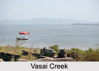 Major Gulfs in India include the Gulf of Cambay, Gulf of Kutch and the Gulf of Mannar.
Gulf of Cambay is located on the Arabian Sea coast of India and borders Gujarat. Gulf of Kutch is located along the west coast of India in Gujarat. Gulf of Mannar is a part of the Laccadive Sea in the Indian Ocean located between the southeastern tip of India and the west coast of Sri Lanka. Major Gulfs in India include the Gulf of Cambay, Gulf of Kutch and the Gulf of Mannar.
Gulf of Cambay is located on the Arabian Sea coast of India and borders Gujarat. Gulf of Kutch is located along the west coast of India in Gujarat. Gulf of Mannar is a part of the Laccadive Sea in the Indian Ocean located between the southeastern tip of India and the west coast of Sri Lanka.
Bays of India Bay of Bengal is located on the eastern side of India and is the largest bay in the world. Back Bay is located off the coast of Mumbai and its water merges with the Arabian Sea. Mahim Bay is a part of the Arabian Sea in Mumbai. Two other Indian Water Bodies in the form of Bays are Peacock Bay and Campbell Bay. Arabian Sea Arabian Sea is a part of the northern Indian Ocean. It is on the east that this sea is bounded by India. Arabian Sea has a maximum width of about 2,400 km (1,500 miles), surface area of about 3,862,000 square kilometers (1,491,000 square miles) and maximum depth of about 4,652 m (15,262 ft). Indian Ocean Indian Ocean is located south of India. It has the distinction of being the 3rd largest of the world’s oceanic divisions. This ocean has a maximum width of about 1,610 km (1,000 miles), surface area of about 70,560,000 square kilometers (27,240,000 square miles), average depth of about 3,741 m (12,274 ft) and maximum depth of about 7,906 m (25,938 ft). Straits in India The Palk Strait separates India from Sri Lanka. The Ten Degree Channel separates the Andamans from the Nicobar Islands. The Eight Degree Channel dissects the Laccadive and Amindivi Islands from the Minicoy Island towards the south. Capes in India Important Capes in India include Cape Comorin, the southern tip of mainland India; Indira Point, the southernmost location of India; Rama's Bridge and Point Calimere. Other Indian Water Bodies Some of the other Indian Water Bodies are canals, ponds and springs. |
| |||


Indian Water Bodies
| Indian Water Bodies include rivers, lakes and other navigable waterways of the nation. |
| ||||||||||||||||||||||||||||

