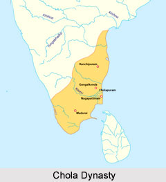
 South Indian villages under Chola dynasty were of various categories and administered according to their own local rules of governance. The main sources for the study of Chola villages are contemporary inscriptions which usually record various donations to the temples. These inscriptions are, however, mostly concerned only with the Brahmadeya villages and very little information on non-Brahmadeya villages can be gathered from them. The term employed in the royal order to signify the village is Ur, which is most commonly used in the Tamil language to mean village. The inscriptions found in the temples in Thanjavur, known as Thanjavur inscriptions, designate three out of thirty-three villages as Nagaram. Nagaram means commercial town. In addition to these, there are five villages which are stated to have been incorporated into a Nagaram and therefore they also can be regarded as Nagarams. Apart from this, other classifications of villages includes Salabhogam, a village or land assigned for the upkeep of a feeding house; and a Pallichchanda, village or land granted to a Buddhist or Jain temple. The other ordinary villages were known as Vellanvagai villages.
A considerable variety is seen in the size of the villages. The extent of most villages was less than 60 Veli though there were some villages which exceeded 100 Veli. Of the villages which were less than 60 Veli in extent, however, it is difficult to find any peculiarity in distribution. The extent of tax-free lands also varies greatly, though not in its proportion to the whole area of the villages.
In the royal order the following three residential areas are enumerated: Urnattam (for the Urar), Paraichcheri (for the Paraiyas) and Kammanachcheri (for the Kammajas). In the records of each village, however, there appear some categories of residential area other than the above three. They are: Kudiyirukkai (for the Kudi), Llachcheri (for toddy drawers), Tindachcheri (for the untouchables), Talai Vaychcheri (for people who control the main sluice) and Talichcheri (for the people connected to a temple). In some villages, Vannarachcheri (for washer men) also appears. It is clear from the above, therefore, that there were many other different residential areas in the village than those three mentioned in the royal order.
Pidagais were the hamlets of some bigger village where Urnattam or Urirukkai existed. Another term referring to village in the Thanjavur inscription is the Kudiyirukkai. However, its meaning is still more obscure, since the meaning of Kudi is not ascertainable. Kudi may mean a cultivator, a family, or just people. In the villages mentioned as Kudi, however, along with Kudiyirukkai, both Urnattam and Paraichcheri also existed, and therefore, Kudi in this case seems to have been tenant cultivators who were economically and socially different from either the Urar or the Paraiyas. Another category of village land was the Kanimunuttu, land assigned to astrologers. Likewise Maruttuvapperu is land assigned to physicians. In some cases, Paraichcheri is specified as Ulapparaiyarirukkum Kilaichcheri (an eastern residential area for the Paraiyas who cultivate) and Ulapparaiyarirukkum Melaipparaichcheri (a western residential area for the Paraiyas who cultivate). This clearly shows that the Paraiyas in those villages were employed for cultivation of land.
As to water facilities, the two terms Kulam (water tank) and Vaykkal (water channel) are mentioned in the royal order of the Thanjavur Inscription. In some cases, it is further specified us Pulattirkulam (tank in a cultivation field), Kakinikkulam (tank in a paddy field), Urunikulam (common tank for drinking water), Urin-Naduvupatta-Kulam (tank situated in the centre of the village), Tirumanjanakkulam (sacred tank for purification), and Paraikulakuli (water pool for the Paraiyas). The term Karai (bund) was also used for some villages. They might have been the bunds of tanks or those of water channels or rivers.
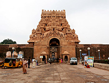
Every village had at least one temple and most of them had more than one temple. The term used to describe a temple is usually Srikoyil or its plural form Srikdyilgal.