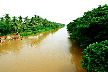
 Visakhapatnam District is one of the North Eastern Coastal districts of Andhra Pradesh and it lies between 17°15 minutes and 18°32 minutes Northern latitude and 18° 54 minutes and 83° 30 minutes East longitude. It is bounded on the North partly by the Orissa and partly by Vizianagaram District, on the South by East Godavari District, on the West by Orissa State and on the East by Bay of Bengal. Visakhapatnam District presents two distinct Geographic divisions. The plains division consists of the strip of the land along the coast and the interior and hilly area of the Eastern Ghats flanking it on the North and West called the Agency Division. The Agency Division consists of hills with an altitude of about 900 metres dotted by several peaks exceeding 1200 metres. Sankaram Forest block, topping with 1615 metres, embraces the Mandals of Paderu, G. Madugula, Pedabayalu, Munchingput, Hukumpeta, Dumbriguda, Araku Valley, Ananthagiri, Chinthapalli, G.K. Veedhi, and Koyyuru erstwhile Paderu, Araku Valley and Chinthapalli taluks in entirety. Machkhand River, which on reflow becomes Sileru River, drains and waters the area in its flow and reflow and is tapped for Power Generation. The other division, the plains division, has an average altitude no where exceeding 75 metres watered and drained by Sarada, Varaha and Thandava Rivers and rivulets Meghadrigedda and Gambheeramgedda.
Along the shore lies a series of salt and sandy swamps. The coast line is broken by a number of bald head lands, the important of them being the Dolphin`s Nose which had afforded the establishment of Natural Harbour at Visakhapatnam, Rushikonda(village) Polavaram Rock and the big Narasimha Hill at Bheemunipatnam. Administratively, the District is divided into 3 Revenue Divisions and 43 Mandals.
 The district has differing climatic conditions in different parts. Near Coast the air is moist and relaxing, but gets warmer towards the interior and cools down in the hilly areas on account of elevation and vegetation. April to June are the warmest months. The temperature gets down with the onset of South West Monsoon and tumbles to a mean minimum of 18.8 degree Celsius by December after which there is a reverse trend till the temperature reaches mean maximum of 37.4 degree Celsius by the end of May.
The district receives annual rainfall of 1202 mm, which are contributed to by the South West and North East monsoon. The rest is shared by summer showers and winter rains. Agency and inland Mandals receive more rainfall from the South-West Monsoon, while Coastal Mandals get similarly larger rainfall from North-East monsoon. However, both monsoons play truant, and as there is no accountability of the monsoons, the district experiences drought conditions too often.
More than the one third of the area in the District is covered by forest. The forests are of moist and dry deciduous type. The common species available in them are Guggilam, Tangedu, Sirimanu, Kamba, Yagisa, Nallamaddi, Gandra, Vepa etc. Bamboo shurbs are sparsely scattered. There has been seen a decline in the forest area of the district due to the podu practice. To stem this, regeneration programmes are being carried out.
 As regards the soil in the district, red loamy soils predominate, and cover about 69.9% of the villages of the district. The Soils are poor textured and easily drained. The next most commonly found soil is of the sandy loam variety. It is largely confined to the coastal areas. Black cotton soils are found in sizeable chunks in K.Kotapadu, Devarapalli, Cheedikada, Paderu and Hukumpeta Mandals. The soils in the district are quite low in organic and phosphorous content.
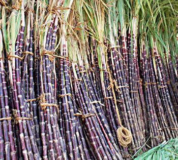
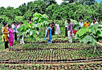
The total geographical area of the district is 11.34 lakh hectares. Of this 30.5% alone is arable area while 42.1 percent is forest area. The rest is distributed among barren and uncultivable land put to non agricultural uses. Agriculture is the mainstay of nearly 70% of the population. Rice is a staple food of the people and paddy is therefore the principal food crop of the district followed by Ragi, Bajra and Jowar, and Cash Crops such as Sugarcane, Groundnut, Sesame and Chillies are important. Since there is no Major Irrigation system, only about 30 percent of the cropped area is irrigated under the Ayacut of the Medium Irrigation System and Minor Irrigation Tanks. The rest of the cultivated area is covered under dry crops depending upon the vagaries of the monsoon. The productivity of the crops is low.
The District has mineral deposits of Bauxite Apatite (Rock Phosphate) Calcite, Crystalline limestone confined to tribal tracts. Bauxite deposits at Sapparla, Jerrila and Gudem of G.K.Veedhi Mandal are considered to be the largest in the country. Phosphate Apatite is available in Kasipatnam village of Ananthagiri Mandal. Rich deposits of crystalline limestone and Calcite are mapped in Borra Caves and along the Valley up to Araku from Borra and around Valasi village of Ananthagiri mandal. Ruby Mica is another mineral available in the District essential for electrical and electronic industries. The mineral occurs in the form of Phologopite and is confined to Borra tract. Quartz is another mineral found mostly in Bheemunipatnam, Padmanabham, Devarapalli, K.Kotapadu and Ananthagiri mandals. Vermiculate found near Kasipatnam of Ananthagiri mandal. Clay deposits near Malivalasa of Araku mandal are identified. Limeshell useful for manufacture of chemical grade lime is also available in the district. Red and Yellow ochre deposits are also identified in Araku and Ananthagiri mandals.


