Home > Travel > States of India > Geography of Sundargarh District
Geography of Sundargarh District
Geography of Sundargarh district, Odisha, exhibits a varied topography having different altitudes and features. The district has a dense forest cover which also caters to the industrial and economic needs.

Share this Article:

Geography of Sundargarh DistrictGeography of Sundargarh district, Odisha, covers a vast variety of landscapes including mountainous terrains, inaccessible forests, isolated peaks and river valleys. The district primarily exhibits an undulating table-land having different altitudes, often interrupted by hill ranges and meandering rivers like Brahmani and Ib. The land of the district has a slope from north to south direction.

Topography of Sundargarh District
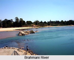
The southern part of the district has the Ib river valley and a well cultivated open land. In the Sadar sub-division of the district, the undulating land rises to an average altitude of 700 feet. At places, it is studded with peaks and hills of about 2000 feet height. In the western part of the district at Hemgir, the land rises gradually to the table-land of Chhotanagpur towards its north. In the area under the Bonai sub-division, situated in south east of the district, there is jagged forest along with hills intersected by passes and gorges. The region also houses a narrow valley of the Brahmani River and its tributaries. During rainy season, the stream of rivers often cuts of the communication. High mountain ranges such as Bichakani and Chheliatoka stand towering on east and west of the river valley respectively. Bichakani hill of the district is much significant as it hosts million of tonnes of iron-ore which finds extensive usage in Rourkela steel plant. The regions of Panposh and Sundargah subdivisions have an altitude of 700 feet above the sea level whereas Bonai sub division has a height of 800 feet above the sea level.

Forest of Sundargarh District
The district houses forests of northern tropical dry deciduous type where the common varieties found are Sal, Kurum and Assan with Sal forming the dominant species. Good quality of vegetation is found in eastern part of Rajagangapur and Bonai regions. Rich mineral resources are found in the forests such as lead, limestone, manganese and iron ore. Some important forest products found in the district are kendu leaf, timber and bamboo, which find great utility in export industries. Previously the forests of Sundargarh district were highly inaccessible which often used to make the communication difficult. However with the practice of shifting cultivation by the tribal population, the forest cover has substantially reduced making them accessible. An area of 3534.92 square kilometres of the district is under the forest cover out of which 612.07 square kilometres area is under protected forest and 2664.64 square kilometres area is under reserved forest. To enhance the revenue generated by the forest products, much emphasis is laid by the state government on afforestation through various programs such as N.R.E.P and D.R.D.A.


Share this Article:

Related Articles

More Articles in States of India


East Indian States
East Indian States comprises of Bihar, Jharkhand, West Bengal, Odisha and also the Union Territory of Andaman and Nicobar Islands. It defines the cultural heritage, rich historical background and the linguistic unity.
Erode District
Erode District is one of the districts in the state of Tamil Nadu. The district of Erode is having a land-locked area with no sea coast.
Purnia District in Bihar
Purnia District is located in Bihar and extends from River Ganga to Nepal. The district has a rich Hindu history and glorious past.
South Delhi District
South Delhi District is the third largest district of Delhi as far as its area is concerned. South Delhi District is known for its economic, historical, cultural and social significance.
North Indian States
North Indian States formed the cultural and religious unity in spite of having many foreign invasion and the political disturbances from the early era till the British gained supremacy in Indian sub continent.
Kendujhar District
Kendujhar District, spread over an area of 8,240 sq kms, is as varied as the whole of Orissa with waterfalls roaring gorges, mountains and minerals. The manifold expressions of nature in Kendujhar District are considered as unique.
Hooghly district
Hooghly District along the bank of the river Hooghly is one of the principal trading ports of West Bengal.
Districts of South Tamil Nadu
Districts of South Tamil Nadu consist of many tourism destinations like archaeological sites and the history of Pandyas and Cholas. Considering their proximity to the sea, many districts also boast of serene beaches and coastal beauty.
Flora of Arunachal Pradesh
Flora of Arunachal Pradesh includes infinite species and is a subject of great interests for the botanists.
Districts of South Gujarat
Districts of South Gujarat are the epicenter of Jain pilgrimages and the early Hindu kingdoms.
North West States of India
North West States of India consist of three states, which are Rajasthan, Punjab and Haryana. All of them are culturally and traditionally diverse and they have been ruled by different dynasties in historical time.
Geography Of Chittoor District
Geography of Chittoor district is spread along the topography of the land which is divided into two natural divisions; Chittoor has a dry and healthy climate.
Districts of North Rajasthan
District of Northern part of Rajasthan is dotted with ancient forts and medieval villages.
Districts of North Odisha
District of North Odisha has Bengal boundary and shares the same culture. These are reachable if one pays a weekend visit to Digha.
Districts of West Bihar
Districts of West Bihar is comprised of medieval monuments that were built by the different governors of Mughal era.
Districts of South Haryana
Districts of South Haryana consists of many cities of industrial excellence. These districts are dotted with popular tourism destinations.
Medieval History of Assam
Medieval history of Assam narrates the advent and rule of a number of kingdoms in the region. The prominent dynasties of the kingdom left an everlasting imprint on the socio cultural heritage of India.
Geography of Meghalaya
The suitable climate, highland plateaus, rivers and the flora and fauna together forms the geography of Meghalaya.
Districts of Rayalaseema
Districts of Rayalaseema in Andhra Pradesh state has urban population and rural settlements as well.
Districts of South Punjab
Districts of Southern part of Punjab depict medieval history of Punjab and the rise of Sikhs.