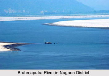
 Geography of Nagaon District is appositely characterized by various highlands, rivers and marshy lands. Geo-morphologically, Morigaon District and Nagaon District together form the shape of a broken dish. Nagaon District is bounded by Sonitpur District and Brahmaputra River on the north, by West Karbi Anglong District and North Cachar Hills on its south, by East Karbi Anglong District and Golaghat District on its east. Geographically, Nagaon District is one of the largest districts of Assam. Its highlands include Hatimura Parbat with an altitude of 186.5 metres, Barkandali with an elevation of 853 metres and Kamakhya Parbat with a height of 244 metres.
Geography of Nagaon District comprises some major rivers like Brahmaputra River, Kalong, Sonai, Nanoi, Yamuna River, Kopili and the Barpani. The major river is the Kalong which divides the town into two halves - Haibargaon and Nagaon. Moreover, there are several beels, marshy lands and swamps; these are actually the old abandoned channels of Kalong and Kopili rivers. These are Marikalong, Potakalong, Haribhanga, Jongalbalahu, Samoguri beel. These beels are the unused resources of the district. There are about two hundred numerous marshy lands here. Northern and the southern regions are uplands. General slope of Nagaon District is towards the west. The eastern, north eastern and the south eastern parts are hilly terrains. Geologically, the soil of Nagaon District is of sandy texture.
Geography of Nagaon District is also determined by the pleasant weather of the region. In fact, it enhances the picturesque topography of this district of Assam. The climate is in general monsoon type. However, there are some differences from the other districts of Assam. The climate is of an extreme type compared to other districts of Assam. The pattern of rainfall is such that the south is usually dry and the north is relatively rainier. Rainfall from south to north increases. The average rainfall is near about 1750 mm. Deforestation, speedy urbanization and global warming, etc. are changing the rainfall pattern of the district. Nagaon District has a vegetation cover of around 12 percent. Temperature in winter varies from a maximum of 24.8 degree Celsius to a minimum of 11.2 degree Celsius. In summer, temperature varies from a maximum of 32.9 degree Celsius to a minimum of 25.5 degree Celsius. The annual average maximum temperature is 30.4 degree Celsius and the minimum is 19.8 degree Celsius.
Thus, it is noticeable that geography of Nagaon District is spread over vast plain lands dotted with fewer hilly terrains. The wonderful climate enhances the topographical features of the region.


