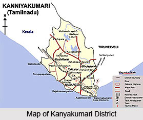
 Geography of Kanyakumari district is favourable with an agro-climatic condition. It is the southernmost district of the state of Tamil Nadu and is bound by the Tirunelveli district on the North and the East. The South-Eastern boundary is formed by the Gulf of Mannar. To the South and the South-West, the boundaries are the Indian Ocean and the Arabian Sea. The West and North-West boundary of this district is formed by the Kerala state. The climatic condition of this district makes it favourable for the cultivation of a number of crops. The proximity of equator, its topography and other climatic factors favour the growth of several various crops. The paddy varieties grown in the second crop season in Thovalai and Agasteeswaram taluks of the district are grown during the first crop season in Kalkulam and Vilavancode taluks. It displays a distinct variation in the climatic conditions within the district. Unlike other district in the state of Tamil Nadu, it has a rainfall both during the South-West and the North-East monsoons. The South West monsoon period starts from the month of June and it ends in September, while the North-East monsoon period commences from the month of October and it ends in mid-December.
According to the agro-climatic and topographic conditions, the district of Kanyakumari can be divided into three regions called the Uplands, the Middle and the Lowlands. The Uplands consist of hills and hill bases favourable for growing crops like cloves, pepper, rubber, nutmeg, pineapple etc. The Middle regions possess valleys and plains fit for growing crops like Tapioca, paddy, banana, coconut, etc and the Lowlands consist of the coastal belt which is suitable for the growth of cashew, coconut, etc. The district of Kanyakumari produces tapioca, paddy and oilseeds like groundnut and coconut apart from the commercial crops like rubber, cashew, fruits and spices. The most prominent feature of this district is the production of off season mangoes. Paddy is the main crop of this district and it is grown in two seasons. While the first crop is sown in April-June, the second crop is raised in the month of September-October.
The forests in this district are verdant and virgin forests and are believed to be seventy five million years old. Out of the total district area of 167130 hectares, the government forests cover an area of fifty thousand four hundred and eighty four hectares. It is about 30.2 percent of the total geographical area of the district. Unlike other districts, this district receives a fair amount of rainfall from both South-West and North-East monsoons. The period of South-West monsoon is from the month of June to September, while the North-East monsoon is from the month of October to December. Rivers also form a major source of irrigation in the district of Kanyakumari and the major rivers in this district are Thamiraparani, Valliar, Pazhayar, Ponniavaikal and Paraliyar.
The district`s coastal environment forms an interface between land and marine water. This eco-system is valuable to humans from the dawn of civilization. The biological and social needs of human beings are readily met by coastal zone. This district in Tamil Nadu with a land mass of one thousand six hundred and eighty four square kilometres has almost all ecosystems; wetlands, forests, freshwater resources, marine, etc. The coastal environment is very important with regard to fish production and fisher folk`s employment. The district`s coastal ecosystem is sixty eight kilometres in length and is studded with forty four coastal fishing villages. Since this district is located at the extreme south of the Indian subcontinent, the coastline is formed nearly by three seas; the Arabian Sea, the Indian Ocean and the Bay of Bengal while the main part of the coast of Kanyakumari district faces the Arabian Sea.


