 Dhamtari District is a district of Chhattisgarh with its headquarters located at Dhamtari. This district was officially created on 6th of July, 1998 by dividing Raipur (currently the capital of Chhattisgarh) along with Mahasamund. The name Dhamtari is abbreviated from `Dhamma` and `Tarai`. Dhamtari District is situated in the fertile plains of Chhattisgarh. This District is situated between 20 degree 42 minutes north Latitude and 81 degree 33 minutes east Longitude. The total area of the district is 2029 sq kms and it is 305 meters above the mean sea level.
Geography of Dhamtari District
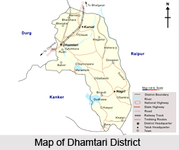
Dhamtari District is surrounded by Raipur District in the north, by Kanker District and Bastar District in the south, by some parts of Odisha in the east and by Durg District and Kanker in the west. Mahanadi River is the principal river of this district and this river is named as Kankannadi, Chitrotpala, Neelotpala, Mandvahini, Jairath, etc. The tributaries of Mahanadi are Sendur River, Pairy, Sondur, Joan, Kharun and Shivnath. The fertility of lands of Dhamtari district can be attributed to the presence of these rivers. The chief crop of this region is Paddy. In the east, Satpura range is located.
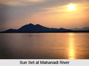 It is popularly known as Sihawa pahad. Mahanadi one of the major rivers in central India, originating in Sihawa Hills flows in the direction of east into the Bay of Bengal. Around 52 percent of the topographical area of the district is covered by forests and the climate of the district is basically tropical.
Administration of Dhamtari District
Dhamtari, Kurud and Nagari are included in the administrative set up of Dhamtari District as tehsils. Dhamtari, Kurud, Nagari and Magarlod are included as blocks. Dhamtari District falls between two Lok Sabha Constituencies (Kanker and Mahasamund) and three Assembly Constituencies (Dhamtari, Kurud, Sihawa).
Economy of Dhamtari District
In Dhamtari District, the total number of Rice Mills is more than 106. Further, Ravishankar Sagar dam that irrigates almost 570 sq kms of land also acts as a main supply unit of safe drinking water resource for state capital Raipur as well as supply unit to Bhilai Steel Plant, which is at almost 11 kms from the district. Moreover, work of 10 MW hydroelectric power plant is progressing and is likely to be completed very soon. Asia`s first ever Siphon dam was built in the year 1914 at Madamsilli. Besides Madamsilli, Sondhur dam, Dudhawa dam are the major projects.
National Highway No. 43 (Raipur - Vijaynagaram of Andhra Pradesh) passes through Dhamtari District. Raipur is located at 78 kms from Dhamtari District.


