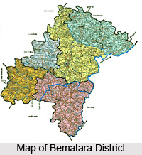
 Bemetara district as it is known came into existence by the division of Durg district on Jan 1, 2012. The district is situated on the North side of the Durg district. The total area of the district is 2854.81 sq. km. and total population of the district is around 795334. The boundary of the district touches seven districts i.e. Durg, Raipur, Baloda Bazar, Bilaspur, Mungeli, Kawardha and Rajnandgaon of the Chhattisgarh State.
History of Bemetara District
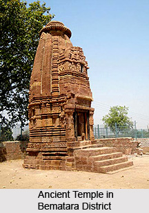
Comparatively a new district in Chhattisgarh, India, Bemetara district was established as tahsil in the year 1907 along with the Mungeli (Bilaspur region). This region is coloured by ever-widening importance in history since the time it had been established. However, it is largest town amongst other town in the scenario of land and population. Owing to its suitability to being a district of Chhattisgarh, it had to wait to call upon since Kawardha has integrated. Conversely, the Chhattisgarh government has realised its importance in central CG. Bemetara is an attractive tourist destination as villages like Bataar, Mohbhatta and Khamhariya are famous for their temples and lakes.
Geography of Bemetara District
 Owing to the geographical location and topographical or the physical features, the climate of the district when taken into consideration may be considered as tropical. Two prominent seasons clouds the climatic sky in the district - the hot summer and moderate winter. In the summer, temperature rises up to 47-degree centigrade. The monsoon season starts immediately after summer until late September. The southwest monsoon brings average rainfall during rainy season and there is no draught prone area in the district. In the district Shivnath, Kharun, Hanf, Sakri, Hamp, Surahi and Phonk River flow. No major dam is constructed in the Bemetara district. Irrigation facility is provided through micro irrigation projects. Many farmers are dependent on the rains and tube wells for irrigation. Hence, much of the `land the district is hardly irrigated.
Economy of Bemetara District
This district is mainly agricultural district. The main crops of Kharif season are paddy, soyabeen, arahar etc. and main rabi season crops are wheat, gram, alsi, mustard etc. District is famous in India as "Unihari District". In the district, Sand is collected from the river delta deposits. Limestone is found at many places in the district. Precious stone Quartz is found in the village of Jevara. Again, medicinal herbs and trees of babool, Mango, Neem, peepal, kouha and khamhar are found in the district.
Most of the people comes under the Indian (Aryans) ethnicity with the further branch under the Deccan indo-Dravidian ethnicity. Bemetara is situated just centre of the Chhattishgarh and an activated participant in trades that is why most of the people in this region are vaishya (trader) and natives are either tribal ones.
Bemetara District
Bemetara District is located at Chattisgarh and is nominated as one of the progressive states although it is a comparatively newly formed state.


