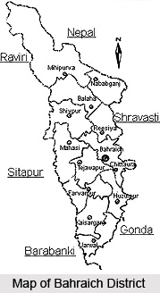
 Bahraich District, an administrative district of Uttar Pradesh, is situated in the north eastern part of Devipatan Division. Bahraich is the district headquarters. It is situated between the 28 degree 24 minutes and 27 degree 4 minutes latitude and 81 degree 65 minutes to 81 degree 3 minutes eastern longitude. Bahraich District has an international border with Nepal on the northern part. It is surrounded by Barabanki District and Sitapur District in its south, Khiri in west and Gonda and Saraswati are in its eastern side. Due to convenience of administration the district is divided into four Tehsils, 14 development blocks, 16 Police Stations, 136 Panchayats and 903 Gram Sabhas.
History of Bahraich District
There are many mythological facts suggesting the history Bahraich District. It was famous as the capital of Lord Brahma. It was also known as part of Gandharva forest. It is said that Lord Brahma developed this forest covered area and this place came to be known as `Brahmaich`. According to some other historians in the middle age this place was the capital of `Bhar` dynasty. Therefore it was called as `Bharraich`, and later became `Bahraich`. Epics like Mahabharata and Ramayana also give reference of this district. According to the history of Bahraich District, it played a great role during the freedom struggle of the country.
Geography of Bahraich District
Northern part of Bahraich District is Tarai region which is covered by dense natural forests. Chakia, Sujauli, Nishangara, Mihinpurwa, Bichia and Baghauli are the main forest areas of the district. Sarju River and Ghaghara River are the major rivers of the district. Climate of the district is hot and humid. The maximum and minimum temperatures range between 44 degree Celsius and 5 degree Celsius. The average rainfall is 1125 mm. Soil of Bahraich District is fertile. Domat, Matiyar, Balui, and Light Domat are the types of soils found in the district. Due to fertile nature of the land greenery is spread throughout the district. Mineral wealth of Bahraich District is almost negligible but the nature has abundantly provided with forest wealth which plays an important role in the economic development of the district.
Tourism in Bahraich District
Bahraich District has many places of religions and historical value. Dargah Sharif is situated 3 kms north of Bahraich city. Dargah of Syed Salar Masood Gazhi is here. It was built by Firoz Shah Tughlaq. Next is Chittaura Jheel that is situated at around 8 kms between Bahraich and Gonda Road. Every year a fair is organized here on Vasant Panchami. Temple of Junglee Nath is one of the most popular tourist attractions of Bahraich District. This is a very old temple of Lord Shiva. Kailashpuri Barrage and Kartaniya Ghat Alligator Breeding Centre are some beautiful place to visit. Tourists can also have joy ride on elephant in the dense forests here.
District Bahraich is connected with railway and road routes to the other parts of the state.
Bahraich District
Bahraich District of Uttar Pradesh comprises dense forests and fast flowing rivers. Economy of Bahraich District is basically agrarian in character.


