Home > Travel > States of India > Districts of Kameng Division
Districts of Kameng Division
Districts of Kameng Divison include tourism destinations like the green valleys and the hilly hamlets.

Share this Article:

Districts of Kameng Division, Arunachal Pradesh
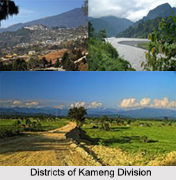
Districts of Kameng Division give one the perfect holiday sojourn while visiting Arunachal Pradesh. Here the districts are Tawang district, West Kameng District and East Kameng district.

Tawang District
Tawang district is the smallest of the 16 administrative districts of Arunachal Pradesh in northeastern India. With a population of 49,977, it is the eighth least populous district in the country (out of 640). The tourism destinations of Tawang district include the beautiful Tawang Monastery, which is quite ancient and it has the early architectural specimens. Jang waterfalls present here draws innumerable tourists every year. There are other tourism destinations like Sela Pass, Bomdila and several other exotic tourist locales, which are the important tourist attractions of the Tawang district.

West Kameng District
West Kameng District is a district of Arunachal Pradesh. It accounts for 8.86% of the total area of the state. The name is derived from Kameng river, a tributary of the Brahmaputra River, that flows through the district. The main tourist destinations of the West Kameng district include Bhalukpong, Lagela Gompa at Morshing, Rupa Caves, Shergaon, Hot spring at Dirang, Shangti, GRL Monestry at Bomdila, Tippi Orchid Centre, Upper Doogjar at Rupa, Sela and Sange, Sela Pass, Nechiphu (Zero Point), Jamiri, Morshing, Dirang Fort, Ruins Of Bhalukpong, Ruins Of Dimachung-Betali. Bomdila at a height of over 2530 metres has a Craft Centre, Apple Orchards and Buddhist Gompas. One can also get the views of Lower Himalayan Mountain Ranges from West Kameng District.

East Kameng District
East Kameng district is one of the 20 districts of Arunachal Pradesh state in northeastern, India. It shares an international border with Tibet in the north and Bhutan to the west, a state border with Assam and district borders with West Kameng District, Papumpare District and Kurung Kumey District, which was bifurcated from Lower Subansiri district on 1st April 2000. East Kameng district is popular for the green valleys. There are three chief valleys in East Kameng district. These are the Pakke-Valley, Pappu Valley and Passa Valley. These places are worth seeing. The indirect rivers make them more beautiful. On both sides of the rivers paddy fields are grown. Lumdung or Passa valley is famous for wandering birds during the winter season. During summer season, the valleys become green with natural beauty. Lumdung-Pappu Valley comes under Seppa Block, Passa and Pakke Valley come under Pakke-Kessang Block headquarter, Pakke-Kessang, is situated in Pakke-Valley. Lumdung (Pappu) is 21 kms, Passa (Rilloh) is 78 kms and Pakke is 140 kms from Seppa, the district headquarters. Pakke-Kessang is a cold place, so it is advised to carry warm clothes while traveling.


Share this Article:

Related Articles

More Articles in States of India


East Indian States
East Indian States comprises of Bihar, Jharkhand, West Bengal, Odisha and also the Union Territory of Andaman and Nicobar Islands. It defines the cultural heritage, rich historical background and the linguistic unity.
Erode District
Erode District is one of the districts in the state of Tamil Nadu. The district of Erode is having a land-locked area with no sea coast.
Purnia District in Bihar
Purnia District is located in Bihar and extends from River Ganga to Nepal. The district has a rich Hindu history and glorious past.
South Delhi District
South Delhi District is the third largest district of Delhi as far as its area is concerned. South Delhi District is known for its economic, historical, cultural and social significance.
North Indian States
North Indian States formed the cultural and religious unity in spite of having many foreign invasion and the political disturbances from the early era till the British gained supremacy in Indian sub continent.
Kendujhar District
Kendujhar District, spread over an area of 8,240 sq kms, is as varied as the whole of Orissa with waterfalls roaring gorges, mountains and minerals. The manifold expressions of nature in Kendujhar District are considered as unique.
Hooghly district
Hooghly District along the bank of the river Hooghly is one of the principal trading ports of West Bengal.
Districts of South Tamil Nadu
Districts of South Tamil Nadu consist of many tourism destinations like archaeological sites and the history of Pandyas and Cholas. Considering their proximity to the sea, many districts also boast of serene beaches and coastal beauty.
Flora of Arunachal Pradesh
Flora of Arunachal Pradesh includes infinite species and is a subject of great interests for the botanists.
Districts of South Gujarat
Districts of South Gujarat are the epicenter of Jain pilgrimages and the early Hindu kingdoms.
North West States of India
North West States of India consist of three states, which are Rajasthan, Punjab and Haryana. All of them are culturally and traditionally diverse and they have been ruled by different dynasties in historical time.
Geography Of Chittoor District
Geography of Chittoor district is spread along the topography of the land which is divided into two natural divisions; Chittoor has a dry and healthy climate.
Districts of North Rajasthan
District of Northern part of Rajasthan is dotted with ancient forts and medieval villages.
Districts of North Odisha
District of North Odisha has Bengal boundary and shares the same culture. These are reachable if one pays a weekend visit to Digha.
Districts of West Bihar
Districts of West Bihar is comprised of medieval monuments that were built by the different governors of Mughal era.
Districts of South Haryana
Districts of South Haryana consists of many cities of industrial excellence. These districts are dotted with popular tourism destinations.
Medieval History of Assam
Medieval history of Assam narrates the advent and rule of a number of kingdoms in the region. The prominent dynasties of the kingdom left an everlasting imprint on the socio cultural heritage of India.
Geography of Meghalaya
The suitable climate, highland plateaus, rivers and the flora and fauna together forms the geography of Meghalaya.
Districts of Rayalaseema
Districts of Rayalaseema in Andhra Pradesh state has urban population and rural settlements as well.
Districts of South Punjab
Districts of Southern part of Punjab depict medieval history of Punjab and the rise of Sikhs.