About Purba Medinipur
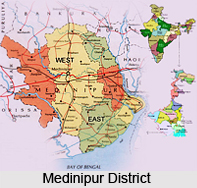 Purba Medinipur district or East Midnapore district is conspicuously an administrative unit that lies in the Indian state of West Bengal. This district lies in the corner most part district of Bardhaman district division that is one of the three administrative divisions of West Bengal the headquarters of which are located at Tamluk. Established on January 1, 2002, this district not only counteracted the ravages of time but even witnessed the Partition of Midnapore into Purba Medinipur District and Paschim Medinipur. Purba Medinipur is confined by states and water bodies on all sides. Orissa is situated at the south-west border of Purba Medinipur district whereas the Bay of Bengal lies in the south; the Hooghly River and South 24 Parganas District to the east and Howrah district to the north-east.
Purba Medinipur is the congregation of the major sub-divisions of Tamluk, Contai and Haldia of erstwhile Midnapore district. Another sub-division, Egra came out of the of the erstwhile Contai sub-division during the partition of Midnapore. However it was in the year 2011, when the state government proposed to Christianise the district as Tamralipta district after the ancient port city of Tamralipta that lied near the modern district headquarters. Purba Medinipur confronted a series of political upheavals during the British Raj. A parallel government named the Tamralipta Jatiya Sarkar was formed during the Quit India Movement in Tamluk.
The Major cities and towns of Purba Medinipur district includes Panskura, Tamluk, Nandakumar, Contai, Egra, Haldia, Mecheda, Mahisadal, Kajlagarh, Digha, Mandarmani, Khejuri, Ramnagar, Patashpur, Bhagabanpur, Manglamarro, Chandipur, Kolaghat, Deshopran Paniparul and Deulihat.
History of Purba Medinipur District
 History of Purba Medinipur traces the progress of the place. History of Purba Medinipur is again telling the tale of economic growth, the cultural development, and the walk of the civilization to the grandeur of success. Some scholars nourish the notion that Tamluk derives its name from the Sanskrit word Tamra Lipta that means "Full of Copper". According to local folklore the name Tamralipta arrived from the King Tamradhwaja (which means The King with Copper Flag/symbol) of the Mayura-Dhwaja (Peacock) dynasty. It may have been that this ancient king treasured a huge base of copper, and the metal was auspicious enough to bring him prosperity to the region at his time. Thus both of the names Tamralipta and Raja Tamradhawja might have been originated from it.
Certain early Vaisnav religious texts formulate a fascinating story about the origin of the name of Tamralipta. Once, when Lord Krishna had indulged in enacting the role of Maharaas in Vraj at Vrindavan as and when Surya (Sun God) Dev rose from the east and accidentally saw Lord Krishna in intimate situation with his Gopis and Sri Radhika. Immediately Surya Dev had felt ashamed, became embarrassed and blush a reddish copper colour like Tamra. And then Surya Dev again returned to the same corner of the east coast of Bharata and did hide (Lipta) himself in the Bay of Bengal. Where Surya Dev went back and hid himself is the place called Tamralipta.
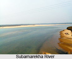
This ancient port city and kingdom was bounded by the Bay of Bengal in the south, river Rupnarayan River in the east and Subarnarekha River in the west. The Rupnarayan is the conglomeration of the river Dwarkeshwar and the river Shilai. The Bay of Bengal and these great rivers and their numerous branches created a prosperous and easy water navigational system fostering commerce, culture and early contacts with the people outside the region. At the same time, these rivers helped to develop the agriculture in this region. Archaeological remains show continuous settlement from about 3rd century BC. It was known as Tramralipti (in the Indian Puranas and the Mahabharata) or Tamralipta (in Mahabharata) or Tamalika (in historical documents) or Tamalitti (in foreigners` descriptions) or Tamluk (in the British Raj). It was a seaport, now buried under river silt. For this reason, Tamluk has many ponds and lakes remaining today.
In the Mahabharata (Bhishma Parba/Nabam Adhyay) while describing the names of the holiest rivers and kingdoms of India, Sanjay took the name of "Tramralipta" to King Dhritarastra. Tamluk was also known as Bhivas (in religious texts) and Madhya Desh (as the Middle State of Utkal/Kalinga and Banga). According to Jain sources, Tamralipti was the capital of the kingdom of Venga and was long known as a port.
Economy of Purba Medinipur District
It was in the year 2006 the Ministry of Panchayati Raj granted Purba Medinipur one of the country`s 250 most backward districts (out of a total of 640). It is one of the eleven districts in West Bengal that is the receiver of grants from the Backward Regions Grant Fund Programme (BRGF).
Education of Purba Medinipur District
The 2011 census states that the district has a literacy rate of 87.66 up from 80.20% of 2001 census. However as per the 2001 census, this district had a male literacy rate of 89.1% and female literacy rate was 70.7%. Education Index of this district is 0.74 and the district is ranked 1st position in literacy rate in comparison to other districts of West Bengal.
Demography of Purba Medinipur District
According to the 2011 census Purba Medinipur district has a population of 5, 094,238. This gives it a ranking of 20th in India (out of a total of 640). The district has a population density of 1,076 inhabitants per square kilometre (2,790 /sq mi). The population growth rate over the decade 2001-2011 was 15.32%. Purba Medinipur has a sex ratio of 936 females for every 1000 males.
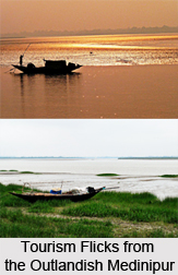
Tourism in Purba Medinipur District
 Tourism in Purba Medinipur district is the exploration of the East Midnapore District and Balasore district in the mouth of Hooghly River and Subarnarekha River with the coastal landform diversity, seasonal and rural and heritage diversity that offers tremendous potential in their typical coastline and the adjacent rural areas.
Tamluk is the district headquarters of Purba Medinipur district and the present town is located on the banks of the Rupnarayan River close to the Bay of Bengal. The Rupnarayan halt is indeed a discovery for the eyes, and peace for the soul. The spot is ever ready for picnic and a cynosure for picnic loving populace.
Tamluk is best reached by Train and Bus. The Tamluk Rajbari lies on the outskirts of town where there is established the District Archaeological Museum a must see place of the town. The Tamralipta Museum at Tamluk contains artefacts of tamra or copper. The inscribed copper templates comprise of the papers and documents of this museum. The museum has preserved a tamralipta of Greek inscriptions. The Tamralipta Museum preserves the historical heritage of Bengal. Rakhit bati is another place to visit in Tamluk. In the beginning of 19th century it was considered as a famous place and a secrete centre of the then revolutionary party "Anusilan Samiti" and "Gupta samiti".
Matangani Sahid Smarak at the side of pond called Banpukur at Abasbari Para near Tamluk Court is another spot of tourist fixation. During the "Ahimsa" movement of 1942, while a crowd trying to capture Tamluk administrative building, British police open fire in which Smt Matangini Hazara became "Sahid". Later on Mahatma Gandhi appreciated her bravery and titled her as "Birangana". This monument is homage to her by Ex- prime-minister, Gandhi. This is about 7Km from Tamluk station and on the way to Tamluk college. Tamluk irrigation Bungalow and it"s near by areas also famous for its semi-non urban atmospheres. The River Rupnarayana is just 1 km from the bungalow. Another very popular picnic destination in Tamluk is green fields near the rail station. Maahishadal and Geonkhali are near by tourist places. At Geonkhali river Rupnarayan joins Hooghly River with a beautiful backdrop.


