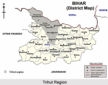
 According to history of Tirhut refers to the Indo-Gangetic plains lying north of the Ganga River, in Bihar. Tirhut, a densely populated area of India corresponds to the ancient region of Mithila. Many rivers cut through these plains. Here the main crop consists of paddy, wheat, maize, and sugarcane.
During the Mughal period Akbar conferred Hajipur as Jagir on Azam Khan. During the sixteenth and seventeenth centuries Tirhut consisted of (i) Hajipur with eleven Mahals and an annual income of about seven lacs, (ii) Champaran with three Mahals and a revenue of about one and a half lac and (iii) Tirhut with seventy-four Mahals and a revenue of about five lakhs. The assessment was made under the supervision of Todar Mal. The duties of revenue collectors were clearly defined. According to Ain-i-Akbari, the revenue collector must be a friend of the agriculturists and he should be truthful. He should be accessible to all. He should assist the needy husbandmen with advances of money. From the time of Jahangir, Tirhut was governed separately from Bihar and Patna for purely revenue adjustment. There is no separate mention of Tirhut revenues in Shah Jahan`s time.
During 1720, Alliwardi Khan conferred upon Raghava Singh of Darbhanga District the title of Raja. Raghava Singh acquired the Mukarrari lease of Sarkar Tirhut at one lakh of rupees annually. He paid annual Nazrana of Rs.50, 000/- to Nawab`s Diwan, Raja Dharnidhara. Raghava Singh was succeeded by Vishnu Singh and the latter was succeeded by Narendra Singh. During his reign Tirhut was subjected for the third time in 1750 to the revision of assessment by Alliwardi. Narendra Singh was harassed by Alliwardi and a war between the two ensued on the bank of Balan River. Narendra Singh became victorious.
This article is a stub. You can enrich by adding more information to it. Send your Write Up to content@indianetzone.com


