 Geography of Katni district covers an area of 4949.59 square kilometers. The district of Katni is situated in the Northeastern parts of the state of Madhya Pradesh in India and also forms the northern district of Jabalpur commissionerate division. Mudwara was the biggest (area-wise) tahsil of Jabalpur before Katni became a district in the year 1998. The Katni district is located between twenty three degree thirty seven minutes and twenty four degree eighty minutes to the North latitude and seventy nine degree fifty seven minutes and eighty degree fifty eight minutes to the East longitude. This district in the Madhya Pradesh state is placed three hundred and ninety two meters above sea level.
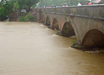
River Katni, River Chhoti Mahanadi and River Umdar are the three major rivers in the Katni district and the name Katni of Mudwara is given after the Katni River, which is two kilometers away from Mudwara. The shape of the district of Katni is roughly oval. The district enjoys an average climatic condition.
The major crops grown in this district are paddy, wheat, gram and pulses. In cash crops, mainly vegetables are grown and sent to market of Satna District and also to Umaria. There is a good market of cereals and other agro-based product in Katni. Krashi Upaz Mandi Katni has been given the status of `A` class mandi in India. The area under cultivation in this district is thirty four thousand five hundred and ninety three hectares in the year 2001, and total forest area consisted of seventy one thousand one hundred and fifty five hectares. Private land in this district is 279020 hectares and Government land comprises of 214072 hectares.
This article is a stub. You can enrich by adding more information to it. Send your Write Up to content@indianetzone.com


