Introduction
Basti District is one of the administrative districts of Uttar Pradesh. Basti town is the administrative headquarters of this district. Total population of Basti District as per 2001 Census is 2,068,922 persons, out which male population is 1,079,971 and female population is 988,951. Population density of the district is 682 persons per sq km. According to 2001 Census, literacy rate of the district is around 54.28 percent (male literacy rate is 68.16 percent and female literacy rate is 39 percent.

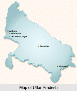
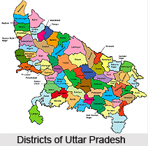
Location of Basti District
Basti District lies between the parallels of 26 degree 23 minutes and 27 degree 30 minutes north latitude and 82 degree 17 and 83 degree 20 minutes east longitude. Its maximum length from north to south is about 75 km and breadth from east to west about 70 kms. The district lies between newly created Sant Kabir Nagar District on its east and Gonda on its west, in the south Ghaghara River separates it from Faizabad and newly created district named Ambedkar Nagar. While on the north it is bounded by district Siddharthnagar.
History of Basti District
According to the history of Basti District, the tract comprising the present district was remote and much of it was covered with forest. But gradually the area became inhabitant. With the passage of time, the place prospered and in 1801 it became the Tehsil headquarter and was chosen as the district headquarter of the newly established district in the year 1865. Ancient history of Basti District states that in ancient times the country around Basti was known as Kosala.
With the decline of the Guptas in 6th century AD, Basti became isolated. At this time a new dynasty, that of the Maukharies, with its capital as Kannauje, assumed an important position on the political map of northern India and perhaps this kingdom in included present district also. In the beginning of the 9th century AD, the Gurjara Pratihara king, Nagbhatta II made this city the capital of his growing empire which rose to its greatest height in the reign of the famous Mihirbhoj (836-885 AD). Jaychandra (1170-1194 AD), the last important ruler of the dynasty was killed in the battle of Chandawar (near Etawah) and soon after his death Kannauj was occupied by the Turks.
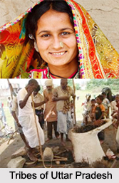
According to legends, for centuries Basti was occupied by the Bhars. However, no definite evidence is available about the origin of Bhars and early history. The evidence of an extensive Bhar kingdom in the district can be traced only from the ruins of ancient brick buildings popularly ascribed to the Bhars and found extant in a number of villages of Basti district.
Medieval history of Basti District suggests that in the beginning of the 13th century, Nasir-ud-din Mahmud, the elder son of Iltutmish, became the governor of Awadh in 1225. In 1479 Basti district remained under the control of the successor of Khawaja Jahan who was ruler of kingdom of Jaunpur. It is said that before the advent of the leading Rajput clans, there were the local Hindu Rajas in the district and they supplanted the aboriginal tribes like Bhars, Tharus, Domes and Domekatars, whom general tradition declares to have been the early rulers of the region. By the last quarter of the 14th century Amorha a part of Basti District was ruled by Kayasth dynasty. Further, according to the history of Basti District, during the reign of Akbar and his successor the district formed a part of the Sarkar Gorakhpur.
According to the modern history of Basti District, huge change occurred when Saadat Ali Khan was appointed governor of Gorakhpur on 9th September, 1772. It further states that the district played a great role in the freedom struggle of 1857. The Non Cooperation Movement began to appear in the district towards the close of 1920. In the preparation for this movement Mahatma Gandhi and Jawaharlal Nehru visited the district on October 8, 1919. The Quit India resolution pass by the All India Congress Committee on August 8, 1942, marked the turning point in India`s struggle for freedom. In Basti the movement had taken a serious turn. In 1946, Congress again returned and it formed the Government. Thus, Basti District had contributed tremendously in the country`s independence.
Geography of Basti District
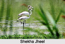
Geography of Basti District in Uttar Pradesh includes two main river systems namely, the Ghaghara River and Rapti River, both of which ultimately form a part of the great Gangetic system. The other streams of the district are the Kuwana, its tributaries are, Rawai and Katnehia, and Ami is a tributary of Rapti. In spite of its apparent uniformity of aspect, topographically Basti District is divided into several distinct tracts namely, the low valley of Ghaghara River in the south, extending from that river to its tributary, the Kuwana; the central upland, between Kuwana river and Rapti river; and the low and ill-drained paddy belt between the Rapti and the Nepal boundary.

River Ghaghara forms the southern boundary of the district, from its entry opposite the sacred town of Ayodhya, where for a short distance it is usually known as the Saryu. During the rains it carries immense volume of water, but in dry weather it shrinks considerably. This river has a constant tendency to change its course during the floods, and in this manner large tracts of land from time to time are transferred either to the northern or southern banks, rendering the total area of the district subject to incessant variation. These changes have occasionally been accompanied by the formation of large islands and deep stream rule prevails, the constant shifting of the jurisdiction of such lands from one district to another results in considerable inconvenience. Kuwana River rises in the low ground in the east of Bahraich District and first touches the district in the stream west of Rasulpur.
The climate of Basti District is more equable than the adjoining districts to the south. The year may be divided into four seasons. The winter season, from mid-November to February is followed by the summer season lasting till the middle of June. The period from mid-June to the end of September constitutes the south-west monsoon season. October to mid-November is the post monsoon or transition period. The average annual rainfall in the district is 1166 mm. During the winter season the mean minimum temperature is about 9 degree Celsius and the mean maximum temperature is 23 degree Celsius while during the summer season the minimum temperature is about 25 degree Celsius and the mean maximum temperature is about 44 degree Celsius. In the south-west monsoon and the post monsoon seasons the relative humidity is high, being above 70 percent. Thereafter the humidity decreases and summer season is very dry.
In the past a large part of the district was covered with forest of Sal and other trees, but since then most of it has been cleared and brought under the plough. However, plantations of fast growing species such as bamboo, Eucalyptus and mango have been raised in the district.