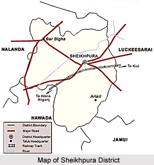
 Sheikhpura District in Bihar is a new administrative district carved out of Munger District on 31st July 1994. District headquarter Sheikhpura is situated at north side of Gaya-Kiul Rail line. Sheikhpura District lies in the southern part of Bihar and is bounded by Nalanda District and Patna District in its north, Nawada District and Jamui District in the south, Lakhisarai District in the east and Nalanda and Nawada districts in the west. Total area occupied by the district is 77705 hectares and it is situated between north latitudes 24 degree 45 minutes and 25 degree and east longitude 85 degree 45 minutes and 86 degree 45 minutes.
History of Sheikhpura District
Though there is no authentic history of Sheikhpura District scripted in any book or records. However, according to references collected from various sources, history of Sheikhpura dates back to the age of Mahabharata. It is believed that in Mahabharata age a demon Hidimba lived on the hillocks situated on its eastern stretch. Bhima married her and she gave birth to `Ghatotkach`. Later on this hill was called `Girihinda` after the name of Hidimba. Girihinda village is still situated here in this region.
According to one belief about six hundred years ago a great sufi saint `Hazarat Makhdum Shah Shoeb Rahamatullah Aleh` had founded the city of Sheikhpura. Later on it became densely populated. During the reign of Pallava dynasty, also Sheikhpura was made one of the chief administrative centres. It is believed that the famous Afghan ruler Sher Shah Suri had got the famous `Dal Kuan` constructed over here. Further, during the Mughal period, Sheikhpura got the status of Thana. In the British period, Sheikhpura was accorded the status of Big Kotwali and after independence; it was given the status of a Block. On 14th of April, 1983 Sheikhpura became a sub-division and on 31st of July, 1994 it was upgraded to the status of a district.
Geography of Sheikhpura District
Topographically Sheikhpura District has two types of region - the rocky highland formed by hilly portion in centre, surrounded by fertile land in north, south, east and west. The land is sloping towards northeastern side. Because of the low-lying area in some parts of the north eastern side, the water gets accumulated during rainy season leading to water-logged conditions. This area is geographically known as Tal area. The district has hot summers and moderate winters. Summers start from middle of March and lasts till July. The monsoon usually breaks in the second half of June and lasts till September. Average annual rainfall received is 1207mm. The district has rich alluvial soil composed of sand, silt and clay in most parts of district. The soil is very fertile and suitable for agriculture. The alkaline and saline deposits are rarely found. There are no big rivers of perennial nature worth to be mentioned in this district. However, there are some small rivers, which flow during rainy season.
Demography of Sheikhpura District
According to the Census of 2011, the Sheikhpura district has a population of 634,927. The district has a population density of 922 inhabitants per square kilometre. Its population growth rate over the decade 2001-2011 was 20.82%. Sheikhpura District has a sex ratio of 926 females for every 1000 males. The literacy rate of this district was 65.96%.


