 Katihar District is an administrative district of Bihar and has its headquarters located at Katihar town. This district is situated in the plains of north eastern part of Bihar. Katihar District is surrounded by Purnia District in the north and West Bhagalpur and Sahibganj districts in the south and West Bengal in the east. Initially, it was one of the sub-divisions of the old Purnia District and was bifurcated as a separate district on 2nd of October, 1973. Katihar District is situated between latitude 25 degree 42 minutes to 26 degree 22 minutes north and longitude 87 degree 10 minutes to 88 degree 5 minutes east.
Katihar District has three sub-divisions - Katihar, Barsoi and Manihari and 16 community development blocks. In Katihar sub-division, the community development blocks are Katihar, Korha, Falka, Sameli, Barari, Kursela, Pranpur, Hasanganj, Dandkhora and Mansahi. In Barsoi sub-division, the development blocks are Barsoi, Kadwa, Azamnagar and Balrampur. Lastly, in Manihari sub-division there are two community development blocks namely Manihari and Amdabad.
Katihar District is an administrative district of Bihar and has its headquarters located at Katihar town. This district is situated in the plains of north eastern part of Bihar. Katihar District is surrounded by Purnia District in the north and West Bhagalpur and Sahibganj districts in the south and West Bengal in the east. Initially, it was one of the sub-divisions of the old Purnia District and was bifurcated as a separate district on 2nd of October, 1973. Katihar District is situated between latitude 25 degree 42 minutes to 26 degree 22 minutes north and longitude 87 degree 10 minutes to 88 degree 5 minutes east.
Katihar District has three sub-divisions - Katihar, Barsoi and Manihari and 16 community development blocks. In Katihar sub-division, the community development blocks are Katihar, Korha, Falka, Sameli, Barari, Kursela, Pranpur, Hasanganj, Dandkhora and Mansahi. In Barsoi sub-division, the development blocks are Barsoi, Kadwa, Azamnagar and Balrampur. Lastly, in Manihari sub-division there are two community development blocks namely Manihari and Amdabad.
Geography of Katihar District
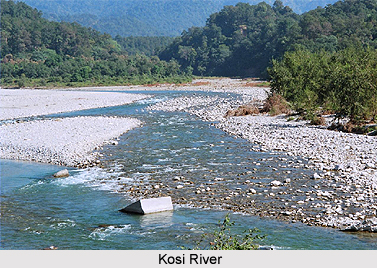
The topography of Katihar District includes three main rivers namely Ganga River, Mahananda River and Kosi River. The district has alluvial soil and it also has a sandy texture. The land is slightly higher in the north and gradually slopping towards the south. The slop is gradual. There is no hill in the district except a small hillock in Manihari Block which is composed of nodular lime stone.
Demography of Katihar District
According to the Population census in the year 2011, Katihar District had population of 3,068,149. Out of which the males and females were 1,601,158 and 1,466,991 respectively. The population of Katihar District constituted 2.96 percent of total population of Katihar District .The population density of Katihar district for 2011 is 1,004 people per sq. km. Katihar district administers 3,057 square kilometers of areas. The average literacy rate of Katihar in 2011 was 53.56 compared to 35.09 of 2001. If things are looked out at gender wise, male and female literacy were 60.99 and 45.37 respectively.
Economy of Katihar District
Rice, Wheat, Maize and Jute are the main crops cultivated in this Katihar District. Further, Katihar District has Jute and Paper Mills industries. The agro based industries and the heavy industries are the backbone of the society.


