 Jehanabad District is an administrative district of Bihar with its headquarters at Jehanabad city. This district was carved out of old Gaya District on 1st August 1986. It was a sub-division of Gaya since 1872. The main aim behind the creation of this district was to accelerate the pace of development in tackling the problems of extremism, poverty, unemployment and underdevelopment. Jehanabad District is situated in between 25 degree to 25 degree 15 minutes north latitude and 84 degree 31 minutes to 85 degree 15 minutes eastern north latitude. Its surrounding districts are Patna District in north, Gaya in south, Nalanda in east and the newly created district of Arwal District in the west. The language spoken here is "Magahi", a dialect of Hindi language.
Geography of Jehanabad District
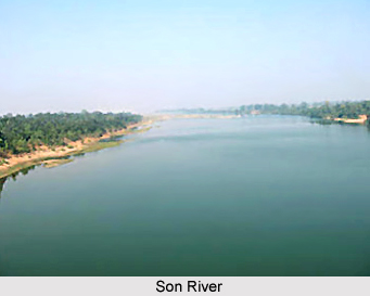
Jehanabad is situated at the confluence of Dardha River and Yamuna River. According to the provisional estimate, major part of the district is plain land. Geography of Jehanabad District comprises some principal rivers that include Son River, Phalgu River, Dardha and Yamuna River. Son River that touches the western part of Jehanabad District is the only perennial river. Rest of the rivers is seasonal. The climate of Jehanabad District is of extreme nature that is very hot in the summers and extremely cold in the winters. The average rainfall of the district is 1074.5 mm. The soil is very fertile, which is very suitable for the production of rice, wheat, cane, etc. However, no major minerals are found in the district.
Demography of Jehanabad District
According to the census 2011, the Jehanabad district has a population of 1,124,176. This gives this district a ranking of 412th in India. The district has a population density of 1,206 inhabitants per square kilometres. Jehanabad District has a sex ratio of 918 females for every 1000 males. The literacy rate of this district is 68.27%.
Economy of Jehanabad District
The economy of Jehanabad District is agriculture based. Jehanabad District is predominantly an agricultural district. The soil is highly fertile. This district is densely populated. Paddy, wheat, maize and pulses are the main agricultural crops raised by farmers in the district. Cane is also grown in some parts of the district.
Tourism in Jehanabad District
Tourism in Jehanabad District includes visits to several places of religious, historical and archaeological importance. There is an industrial area in the district of Jehanabad, which is spread in the area of six acres on Jehanabad-Kako Road. Jehanabad District is linked by both road route and rail route.


