 Geography of Madhubani District in Bihar consists of a vast low-lying plain intersected by numerous streams and marshes, but traversed in parts by upland ridges. The land is generally high, especially in blocks of Benipatti, Madhubani, Jainagar, Ladania, Laukaha and in the south of Phulparas, which contain stretches of highland. The soil of Madhubani District is highly calcareous. It is a mixture of clay and sand in varying proportions. Geography of a major part of the district includes clay. This contains negligible proportion of sand and since it can retain moisture, it is suitable for paddy cultivation.
As far as the shape of the region is concerned, the district resembles a parallelogram, its mean breadth from west to east being a little greater than its mean length from north to south. Further, topographical features of Madhubani District also consist of a rich alluvial plain traversed by several rivers running almost parallel to each other from north to south. The important rivers of the district are Bagmati River, Kamla River, Kareh River, Balan River and Tiljuga River. The Bagmati enters the district at Bishanpur Agropatti about 16 kms west of Benipatti, and after being joined by its tributary Dhaus near Bankatta. It takes a south- easterly course. Kamla River frequently changes its course and its beds are found all over the northern part of the district.
Geography of Madhubani District is characterized by moderate and healthy climatic conditions. The climate of this district includes three well marked seasons, namely a pleasant cold season, a hot, dry summer and the rainy season. The cold weather begins in November and continues up to February, though March is also somewhat cool. Westerly winds and dust storms begin to blow and the temperature goes up to about 42 degree Celsius. Rains set in towards the middle of June when the temperature begins to fall and humidity rises. It continues till the end of September or the middle of October and these months are not so hot. Madhubani District gets more rain than its adjoining districts. Maximum rainfall occurs between the second half of July and first half of August. The average annual rainfall in the district varies between 900 mm and 1300 mm. The district also gets some winter rain.
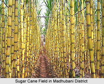
Land in the district is mainly low and produces one crop in a year, and so the necessity for high cultivation does not arise. So far as agricultural production is concerned, the district is mainly a paddy and sugarcane growing area. Madhubani District, like other districts of North Bihar, is dependent for its crops on the local rainfall. However, a considerable part of the district is flood prone.


