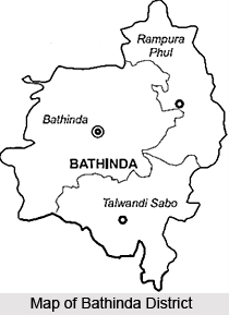
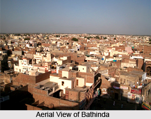
 Bathinda District is situated in the southern part of Punjab in the heart of Malwa region. Bathinda is the administrative headquarters. It forms part of newly created division Faridkot Revenue Commissioners Division and is situated between 29 degree 33 minutes and 30 degree 36 minutes north latitude and 74 degree 38 minutes and 75 degree 46 minutes east longitude. Bathinda District is surrounded by Sirsa and Fatehabad of Haryana in the south, Sangrur and Mansa District in the East, Moga in the North-east and Faridkot and Muktsar in the north-west. According to Surveyor General of India, Bathinda District covers an area of 336725 hectares and is sixth in terms of area in the state.
History of Bathinda District
Bathinda District derives its name from the district headquarters town of Bathinda, which has a rich past. According to Khalifa Muhammad Hassan, author of History of Patiala, its ancient name was Bikramgarh. History of Bathinda District, Bathinda was known as Tabarhindh (Labb-ut-Twarikh). The earliest mention of Tabarhindh occurs in the `Jami-Ul-Hakayat` written around 1211 AD. History also states that the town was conquered by Maharaja Ala Singh (in around 1754 AD) and since then it followed the history of erstwhile princely state of Patiala. With the dawn of independence and after the amalgamation of Patiala and East Punjab into a division known as PEPSU, Bathinda become full fledged district.
 Geography of Bathinda District
Geography of Bathinda District includes mostly sandy soil. Topography of this district of Punjab is basically spread over sandy plain region. It is also dotted with scattered sand dunes which have a tendency to shift towards eastern side. But with the development of latest technology and machinery the topography is under vast change with respect to various aspects connected with green revolution. Bathinda District lies in the south-western region of the state and is far away from the Shivalik ranges in the north of the state. It is nearest to Thar Desert of Rajasthan and also far away from the major rivers lines that run through the state. Therefore, climatically, the district has a hot summer. It has a mild rainy season and a dry but embracing winter. Due to the extension of irrigation facilities during the past few decades, the weather has undergone a change. Further, dust storms are a regular feature in summer season when mercury level rising up to 47 degree Celsius in the peak summer month in June. The monsoon is scanty and not enough. The average rainfall is 410 mm. On the other side the nights as in the desert area are cool and pleasant during December and January.
Demography of Bathinda District
According to 2001 Census, the total population of Bathinda District is 1183295. This district is in the 9th position in Punjab in terms of population density and it accounts for around 4.86 percent of the total population of the state. The sex ratio according to census 2001 is 865 females per thousand male in district which. Though the rate of population growth is too little yet the density of population has increased. Population density in the district is 390 per sq km. Punjab ranks 16th in terms of literacy. Bathinda district is in the 14th position in the field of literacy within the state. Total literacy rate of the district is 61.51 percent, of which male literacy rate is 68.31 percent and female literacy rate is 53.76 percent.
 Administration of Bathinda District
Administration of Bathinda District is divided into three Tehsils namely Bathinda, Rampurphul and Talwandisabo. These tehsils of Bathinda District have been further divided into 8 blocks and these are Bathinda, Sangat, Nathana,Rampura, Phul, Maur, Bhagta Bhaika and Talwandisabo. Bathinda District consists of 285 villages out of which 281 are inhabited and 4 are uninhabited, eight towns and one census town.
Tourism in Bathinda District
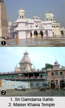
Bathinda District is known for its historical and some significant religious sites. It is one of the most popular tourist attractions of the state. The major places of interest offered by tourism in Bathinda District include Damdama Sahib, Maiser Khana, Zoological Park, Qila Mubarak, Rose Garden and Guru Nanak Dev Thermal Plant & Guru Hargobind Thermal Plant. Rose Garden is a 10 acre garden, popular for the large varieties of roses that grow here. From the historical point of view, one of the important places in the district is Talwandi Sabo or Damdama Sahib, which is connected with the history of Sikhs. All these tourist attractions are worth visiting.
There are several industries in Bathinda District like Guru Nanak Dev Thermal Plant, Bhatinda Chemicals Limited, National Fertilizers Limited, Vardhman Polytex Limited and more.


