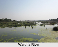
 Geography of Yavatmal district is determined to a great extent by its location. The district of Yavatmal is situated in the eastern region of the state of Maharashtra. It is bounded by the Hingoli district and Washim district in the west and Amravati district and Wradha district in the north. To the east lies the Chandrapur district and to the south lie the district of Nanded and the state of Andhra Pradesh. The district consists of masses of hilly country broken by broad valleys and partially surrounded by plains. The southern half of Yavatmal taluka, which is just in the middle of the district, is a plateau with very steep sides. Here and there it rises into ridges or into flat-topped or pointed hills. Steep, rough ranges of hills occur to east and west right across the district. In the north, the district extends into the Payanghat valley of Berar. The Wardha valley, which marks the boundary of the district for over a hundred miles, continues this belt of plain across the north of Kelapur taluka and the northern and eastern sides of Wani taluka. The chief rivers are the Wardha River and the Penganga River both of which flow along the boundary of the district. Each has various tributaries, which traverse its centre. The Penganga River gives a strip of plain in many parts of its course along the southern border of the district. The tributaries of the Penganga again have formed valleys, often some miles in breadth, through the hilly country.
The climate of the district is in general hot and dry with moderately cold winters. The year may be divided into four seasons. The hot season begins in March and extends up to the first week of June. May is generally the hottest month of the year with the mean daily maximum temperature at about 42 degrees Celsius. This is followed by the south west monsoon season which lasts up till the end of September. With the onset of the south west monsoons there is an appreciable fall in temperatures and the weather becomes pleasant. October and November constitute the post monsoon season and is followed by the cold season which lasts up till February. From about the end of November both day and night temperature fall rapidly and December is usually the coldest month of the year with the mean daily minimum temperature at about 13 C. Most of the total annual rainfall is reserved during the south west monsoon season. The rainfall is not uniform in all parts of the district. Wani in the eastern part of the district receives 1,125 mm of rain and Darwha in the western, part of the district receives 889 mm of rain Yavatmal in the central portion of the district receives 1099.5 mm of rain. In general, the amount of rainfall increases as one proceeds from west to east. The average rainfall received by the district is around 964.7 mm. There is generally a breeze in the hot weather, so that the nights are cool. The cold waves over northern India sometimes affect the district and the minimum temperature may drop to about 5 degrees Celsius.
In Yavatmal district the Archaean rocks, which consist of crystalline rocks of various kinds, were entirely covered by Puranic rocks, which consists mainly of sediments. These were covered in turn by the Gondwana system, consisting of sub aerial and freshwater deposits. Next, the Deccan traps were spread over all. Finally the action of the atmosphere removed the Decan trap in parts, exposing, Gondwana and Lameta beds. During the last stage alluvial soil, the common black cotton soil was spread over parts of the district.
Purana rock is found at various places in the south. It consists of shales, slates, limestones, and sandstones. The shales are deep red, fine grained, with a somewhat nodular structure, much jointed, but irregularly breaking up into small, minute, angular fragments. Thin beds of limestone occur in them. Capital section of these rocks is seen in the Penganga and its tributaries. At Yenuk, south of the Wani taluka there is a hill formed of Purana sandstone. It contains several bands of conglomerates in which pebbles of hematite are found. Iron-ore used to be made from this hematite. Rocks belonging to the Gondwana system are also found in Wani taluka. They occupy its south eastern half. Like the Purana rocks they are often shales, slates, limestone, and sandstones. Unlike them, they often take the form of coal. There is a large coalfield in Wani taluka which extends under Wardha to Warora in Chandrapur district and under the Penganga into the Nizam`s Dominions. At Wanjra above five miles north of Wani town a small hill is composed of pinkish limestone of this bed. West of Wani the limestone continues varying in colour from buff to dark grey, and contains chert, passing into jasper in tolerably regular layers. To the west and north of Kayar there is deep angle in the trap and beds which are possibly Lameta. Deccan trap is spread over the greater part of the district. In the southern half it forms irregular hills, and some of these in Pusad taluka are nearly 2000 feet high.


