 Geography of Nanded district shows some interesting regional variations in the terrain, soils and land use in the different parts of the district. South of the Godavari valley, the area may be broadly divided into western, central and eastern sub-regions. In the western region, the hill slopes are covered with less vegetation than in the other parts of the district and the soils are stony and thin, though mostly black. As a consequence there is only one crop season, viz., kharif. In addition to jowar, cotton, tur and ambadi, the universal crops of the district, there is intensive sugarcane cultivation under well irrigation in the level lands throughout this region. The underground water resources are fairly abundant and in fact this region has the maximum irrigated area under wells, in the whole district. Northwards towards the Godavari River the hill slopes have a greater cover of vegetation. The soils are lateritic and here groundnut, til and some bajra are raised in addition to cotton and jowar.
In the central sub-region of eastern Mukhed, western Deglur and western Biloli, the soils attain greater depth and are more fertile and hence rabi crops are grown in addition to the kharif. There is a rich variety of crops grown, viz., jowar, cotton, tur, ambadi, groundnut, chillis, sugarcane, plantains, wheat, linseed, niger-seed and til.
The eastern sub-region consisting of the eastern parts of Biloli and Deglur talukas is made up of gneissic terrain interspersed by volcanic plugs of flat topped plateaus and is, clearly marked off from the rest by its numerous tanks with paddy cultivation below them.
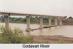
The Godavari valley with its deep fertile black soils may be considered as a distinct sub-region. Though no irrigation is practised using the river water, the rich soils on either bank are used for the intensive cultivation of rice, plantains and chillies in addition to cotton and jowar. However, about 16,592.12 hectares (41,000 acres) of the Nanded taluka are irrigated by the left bank canal taking off from Siddheshwar dam of the Puma Project in the Parbhani district. In the neighbourhood of Nanded town, there is intensive cultivation of vegetables. In the month of August there is always the danger of the crops being washed away by floods.
North of the Godavari valley the area may be broadly divided into two sub-regions, a western one consisting of Hadgaon taluka, and eastern one of Kinwat and Bhokar talukas.
 In the Hadgaon taluka the black soils are very deep especially on the Penganga river bank. Though wheat is the most important crop of this taluka, there is widespread cultivation of plantains and sugarcane under wells in addition to cotton and jowar. Taking the taluka as a whole, if the rains are moderate there is a good yield of cotton and jowar and when excessive, though these crops are damaged, the succeeding wheat yields abundantly, so that famine is practically unknown in this taluka.
The eastern region consisting of Kinwat and Bhokar talukas is very hilly and the soils are not as deep as in the west. The slopes are covered with extensive forests, which have not been denuded. The forests are of the dry mixed deciduous type with teak as the most valuable species. The associates of teak are salai, dhavada, ain, moyana, etc. The quality of growth in Kinwat taluka is better than in other parts of the district. Furniture making industry is located mainly at Nanded and Kinwat, where timber is cut into sizes and sold. The forests of Kinwat taluka are being worked under `coppice with reserve system` with a felling cycle of 40 years. Consequent to the opening of the railway line through this tract, the area under cultivation is of late expanding at the expense of the forest especially in the neighbourhood of the railway line. The usual crops are jowar, cotton and tur with sugarcane and plantains under wells.
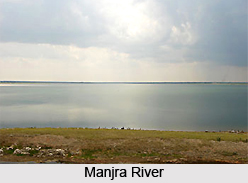
The principal rivers of the district are the Godavari river, Penganga, Manjra River and Manar. The climate of this district is generally dry except during the south-west monsoon season. The year may be divided into four seasons viz., the cold season, the hot season, the south-west monsoon season and the hot monsoon season. The cold season is from November to the end of February. This is followed by the hot season which extends up to the first week of June. The south-west monsoon season, which follows thereafter, lasts till about the first week of October. The rest of October and the first half of November constitute the post-monsoon season. December is the coldest month. with the mean daily minimum temperature at about l3 degree Celsius, and the mean daily maximum at about 29 degree Celsius. May is the hottest month of the year with the mean daily maximum temperature at about 42 degree Celsius. On individual days the temperature sometimes goes up to 45 to 46 degree Celsius. The average annual rainfall in the district is 897.8 mm. About 88 per cent of the annual rainfall is received during the south-west monsoon season.


