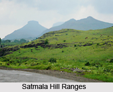
 Geography of Jalna district is such that the district has a moderately to gently sloping undulated topography. The northern part of the district is occupied by the Ajanta and Satmala hill ranges. A major portion of the district, almost 95 percent, falls in the Godavari river Basin. The Godavari River flows along the Southern boundary in a west to east direction. The major tributaries of the Godavari River which flow through the district are the Dudhana River, Gulati River and the Purna River. A huge part of the district falls in the Purna sub-basin. The Purna River flows through the flows through the central part of the district and meets the river Godavari in the neighbouring district. The Rivers Khelna and Girja are other important tributaries of the river Purna which flow through the district. A very small part of the district in the north-eastern part lies in the Tapi River basin. The general slope of the district is towards the southeast, and the average altitude above mean sea-level is 534 metres.
The district has a sub-tropical climate, in which the bulk of rainfall is received from the southwest monsoon, between June and September. The average annual rainfall of the district ranges between 650 to 750 mm. The district often experiences drought with rainfall recording as low as 400 to 450 mm. The rainy season is followed by winter, which lasts up to February. During this time, the minimum temperature ranges between 9 to 10 degree Celsius and maximum temperature ranges between 30 and 31 degree Celsius. The winter is followed by hot summer, which continues up to June. The maximum day temperature ranges between 42 and 43 Celsius during summer.
The entire district is occupied by basaltic lava flows of the Deccan traps of upper cretaceous to Eocene age. The lava flows are piled over one another. The individual flow thickness ranges between 20 to 30 metres. 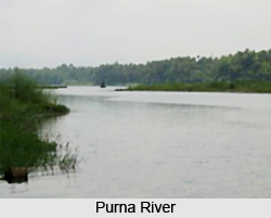 The individual flow has two distinct units. The upper part is vesicular in nature and vesicles are filled with secondary minerals like zeolite and quartz (e.g. Moss Agate, Zebra Agate and Green Agate) which is often called zeolitic trap. The lower part of the lava flow forms the massive basalt, and is often called massive trap. Alluvial deposits along the major rivers overlie the Deccan traps. The alluvium consists of clay, silt and sand. The thickness ranges between 10 to 20 metres. The alluvium forms a very fertile land. Since the major part of the district forms the moderately dissected basaltic plateau, it has moderate to good groundwater potential. The northern part of the district forms the highly dissected basaltic plateau, and consequently the groundwater potential here is quite poor.
Of the total geographical area of the Jalna district, around 85 percent is under agricultural use. Out of the total 7, 61,200 hectares of the geographical area, 6, 51,553 hectares of land has been put to agricultural use. The major portion of this area, around 75 percent, is under Kharif crops, whereas the rest is under Rabi crop cultivation. Among the major crops grown in the district are jowar, wheat and cotton. Around 15 percent of the area is double-cropped whereas only 7.8 percent of the area is irrigated which is far below the state average.


