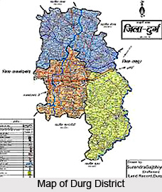
 Durg District is a populous district of Chhattisgarh and it was formed on 1st of January, 1906. In the beginning present Rajnandgaon and Kawardha districts were a part of Durg District. In the year 1973 Durg was divided and separate Rajnandgaon district came into existence. Since then present Durg District is existing with its headquarters at Durg. District headquarters are located at Durg. This district of Chhattisgarh occupies the southwestern part of Chhattisgarh plain and possesses belts of hilly country in the south, southwest and northwest, bestowed with mineral resources and forests. Durg District is located between latitude 20 degree 23 minutes and 22 degree 2 minutes north and longitude 80 degree 46 minutes and 81 degree 58 minutes east. The altitude of the district is 317 metres above the mean sea level. Durg District occupies a total geographical area of 8537 sq kms. Forests account for around 9 per cent (764 sq kms) of the total geographical area. As per the Census record of 2001, the total population of the district is 2,810,436. Until the year 2000, this district was a part of Madhya Pradesh.
Geography of Durg District
Durg District occupies the southwestern part of the Upper Sheonath-Mahanadi valley and the bordering hills in the south and southwest. Physiographically, the District can be divided into two divisions, viz. the Chhattisgarh plain and the Southern Plateau. The Chhattisgarh plain occupies the largest area in this district. Further, geography of Durg District also includes several rivers and their tributaries. The general slope of this district comes under Mahanadi River slope and is towards the north and locally in some places towards east. The main rivers of Mahanadi are Sheonath, Kharun, Tandula, Kharkhara and Aamner. Sheonath is the main river of Durg District which originates from Panabaras Hill and flows towards north-east. This river is the main tributary of Mahanadi River. The total length of the Sheonath River is around 345 kms and its length in Durg District is near about 120 kms.
Tandula River flows through Durg District. This river originates from hills situated in the north of Bhanupratappur (Kanker District). After covering a long distance of 34 kms, this river joins Sukhanala. This river joins Sheonath River in the south-west of Durg District at a distance of approximately 13 kms. The total length of this river is around 96 kms. Kharun River originates from Petechuva in the south-east of the district and after covering 80 kms joins Sheonath River near Somnath in the north. Sheonath River flows nearer to the western border of the district whereas river Kharun forms the eastern border of the district. The length of Kharun River is around 120 kms. The area around Kharun River is very fertile. Moreover, Kharkhara River originates from hills situated in Dalli Rajhara in the south-west of the district. This river joins Sheonath River after covering a distance of 90 kms towards north-east. To fulfill the water requirement of Bhilai Steel Plant and Industry, in 1965-66, Kharkhara Dam was constructed. This is situated at Petechuva village at Balod Tehsil.
 Durg District is very rich as far as its mineral resources are concerned. In the district, Limestone, Iron ore, Quartzite, Manganese and Dolomite are found in abundance. The iron ore of the district is in the form of Hematite. The mines of iron ore is located at Rajhara hills and Jharandalli which are mainly used by Bhilai Steel Plant. In the district, high quality Limestone is available which are located at Nandini, Semriya, Ghidiya, Khundani, Pithoura, Sahgaon, Deourjhal, Ahivara, Achouli, Matragota, Ghotwani, Medesara, etc. In the district Quartzite is mined at Khursul, Kalkasha and Danitola. Dolomite is mined at Mohbhatta, Kodava and Tala. In this district, white clay is mined at Kuvagondi and Petechuva.
Durg District generally has a dry tropical weather which is moderate but on a warmer side in the summer season. The peak temperatures are usually reached in May and June and can be as high as 45 degree Celsius. The onset of monsoon is usually from July and the season extends up to September. Annual maximum, average and minimum rainfall of Durg District are 1477 mm, 1071 mm and 781 mm respectively.
Culture of Durg District
Durg District is rich in cultural heritage. The unique and vibrant culture of this district reflects the colourful life of the people. Several tribal communities are spread over the district. The rhythmic folk music, dance forms and dramas are a treat to watch and they also provide an insight into the deep culture of Durg District. One of the popular dance-drama of the region is Pandwani. It is a musical recitation of Mahabharata.
Tourism in Durg District
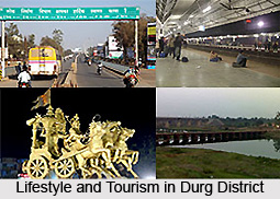
Tourism in Durg District includes several sightseeing options like Twin City Durg-Bhilai, Maitri Bagh, Devbaloda, Balod, Nagpura, Kharkhara and Tandula.
Maitri Bagh
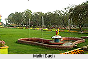
It features landscaped garden which is a joint initiative of Indian and Russian government and a Zoo. The highlights of Zoo are exotic animal and avian species, lake, toy trains and others. The musical fountain, situated on the island in the artificial lake in Maitri Bagh is a splendid sight.
Devbaloda
 Located at 3 km from Bhilai, this place is famous for its ancient Shiv Mandir.
Balod
Located around 58 km from the district, Balod houses several Prachin Kila or oldest palace and temples.
Nagpura
It is a site where the exquisite Jain Temples are worth visiting.
Tandula
It is located at around 60 km from Durg. The prime attraction of this place is a Dam on Tandula River. It is an exciting picnic spot also.
National Highway No. 6 (Mumbai - Sambalpur - Kolkata) is the major highway of the district. Nearest airport from the district headquarters is at Mana (Raipur).


