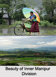
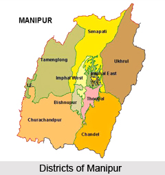
Districts of Inner
Manipur Division include districts like
Bishnupur district, Imphal West district, Imphal East district, Thoubal district and Kakching District. These districts in medieval era are the abode of
Ahom Dynasty.
Bishnupur District: Bishnupur district is the smallest administrative district of Manipur. The name of this district is derived from a Vishnu Temple that is situated at Lamangdong. Major towns of
Bishnupur District are Bishnupur,
Nambol,
Moirang, and Kumbi.
Imphal West District : Imphal West district is one of the nine districts of Manipur. As of 2011, Imphal West district is the most populous district in the state. Lamphelpat is the district headquarters of Imphal West district in the state of Manipur. It is a suburb of Imphal city.
Imphal East District : Imphal East district is one of the 9 districts of Manipur state in northeastern India. As of 2011, Imphal East district is the second most populous district in the state, after Imphal West. Agriculture is the main occupation of the people in Imphal East district. In the district, there are 27,000 and 4,100 hectares of land for high yield variety and improved local paddy field respectively. There are land of 450 hectares for maize, 60 hectares for wheat and 350 hectares for potato in the Imphal East district.
Thoubal District : Thoubal district is one of the nine districts of Manipur state in northeastern India. Senapati district on the north, Ukhrul and Chandel districts on the east, Churchandpur and Bishnupur districts bound this district on the south and Imphal West and Imphal East districts on the west. The district occupies an area of 519 square km. The population as of 2011 is 422,168. Thoubal town is the district headquarters. Thoubal district is known for Khongjom, where the last battle of the independence of Manipur was fought in April 1891 against the army of British Government in India. The
Imphal and the Thoubal are the most significant rivers that flow through the district. The Thoubal River originates in the hill ranges of Ukhrul and is an important tributary of the Imphal River. It passes through Yairipok and Thoubal before joining the Imphal at Irong near Mayang Imphal. The Imphal River rises in the hills of
Senapati district and flows south. It forms the northern and western boundaries of Thoubal district. There are other rivers in Thoubal district namely the Wangjing, the Arong and the Sekmai. These rivers originate in the hills of Ukhrul district. The Arong River flows through Khangabok and falls into Kharung Pat. The Wangjing River flows west via Heirok and Wangjing before joining the Loushi Pat.
Kakching District : Kakching District is one of the 16 districts of Manipur state. Kakching District is bounded by Thoubal district on the north, Ukhrul District and Chandel District on the east, Churchandpur District and Bishnupur district on the south and Imphal West District and Imphal East district on the west. The Kakching district is one of the newly formed districts by the government of Manipur in 2016.
 Districts of Manipur hold the history and culture of India. The state of Manipur is popular for Manipur classical dance and is also the founder of polo in India. The name Manipur literally meaning `A jewelled land` nestled deep within a lush green corner of North East India. Surrounded by blue hills with an oval shaped valley at the centre this state of north east India is rich in art and tradition. This is the place where Rajashree Bhagyachandra created the famous Ras Lila, the classical dance of Manipur. The folk dances of Manipur reveal the mythological concept of creation of this region.
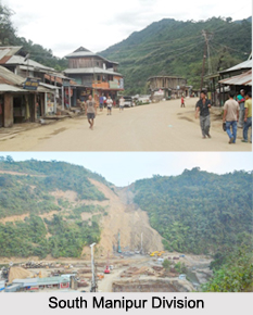 Districts of South


