Home > Travel > States of India > Geography Of Kodagu District
Geography Of Kodagu District
Geography of Kodagu district is determined by its mountainous configuration; the major river flowing through the district is the Kaveri River.

Share this Article:

Geography Of Kodagu District, Karnataka
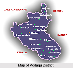
Geography of Kodagu district is greatly influenced by its mountainous terrain. Kodagu district, located in the state of Karnataka, comprises of three taluks- Madikeri, Somwarpet and Virajpet. The headquarters of Kodagu is the hill station of Madikeri. Kodagu district runs a length of 96 Kms from the Hemavathi River in the North to the Brahmagiri hills in the south. Its greatest breadth from Sampaje in the west to Kushalnagar in the east is about 60 Kms. The district has an area of 4,102 Sq.km and 30 percent of the district is forest area.

The district has a mountainous configuration which presents a grand panorama of verdant valleys, ravines, fast flowing streams, lofty peaks and awe inspiring spurs. The major peaks are the Tadiandamol peak, Brahmagiri and Pushpagiri Hills. The largest river in Kodagu district is the Kaveri River with its principal tributaries Hemavathi, Lakshmanathirtha, Kakkabbe and Harangi or Survanavati, and it flows in an easterly direction and Barapole river flows towards west.

The climate of Kodagu is cool, equable and pleasant. The district has a very moist and rainy monsoon climate. Winter lasts from January to February, summer from March to May, South-west monsoon from June to September and the North-East monsoon from October to December. Heavy rainfall is experienced in the months of June, July and August, with July being the rainiest month. The rainfall during the duration of the South-West monsoon forms about 80 percent of the annual rainfall in the region of the Western Ghats Mountain range. Bhagamandala, Pullingoth and Makutta are three of the 14 heavy rainfall stations in India, the other station in Karnataka being Agumbe in Shimoga district.

The mean daily minimum temperature is the least in January at about 14.2 degree Celsius. During December to February the minimum temperature may go down to 6 degree Celsius. Temperature begins to increase from mid February and reaches climax in April and May with mean daily maximum temperature at 28.6 degree Celsius. With onset of south-west monsoon temperature decreases in June and weather becomes pleasant.

As is typical of all tropical rainforests, vegetation of Kodagu district is precariously perched on the thin layer of rich humus and topsoil which wash away the moment the trees and vegetation are removed from it. Torrential rains followed by landslides bare the land, leaving exposed rocks and stones on which no vegetation can be grown again, except perhaps eucalyptus, acacia tree or silver oak.


Share this Article:

Related Articles

More Articles in States of India


East Indian States
East Indian States comprises of Bihar, Jharkhand, West Bengal, Odisha and also the Union Territory of Andaman and Nicobar Islands. It defines the cultural heritage, rich historical background and the linguistic unity.
Erode District
Erode District is one of the districts in the state of Tamil Nadu. The district of Erode is having a land-locked area with no sea coast.
Purnia District in Bihar
Purnia District is located in Bihar and extends from River Ganga to Nepal. The district has a rich Hindu history and glorious past.
South Delhi District
South Delhi District is the third largest district of Delhi as far as its area is concerned. South Delhi District is known for its economic, historical, cultural and social significance.
North Indian States
North Indian States formed the cultural and religious unity in spite of having many foreign invasion and the political disturbances from the early era till the British gained supremacy in Indian sub continent.
Kendujhar District
Kendujhar District, spread over an area of 8,240 sq kms, is as varied as the whole of Orissa with waterfalls roaring gorges, mountains and minerals. The manifold expressions of nature in Kendujhar District are considered as unique.
Hooghly district
Hooghly District along the bank of the river Hooghly is one of the principal trading ports of West Bengal.
Districts of South Tamil Nadu
Districts of South Tamil Nadu consist of many tourism destinations like archaeological sites and the history of Pandyas and Cholas. Considering their proximity to the sea, many districts also boast of serene beaches and coastal beauty.
Flora of Arunachal Pradesh
Flora of Arunachal Pradesh includes infinite species and is a subject of great interests for the botanists.
Districts of South Gujarat
Districts of South Gujarat are the epicenter of Jain pilgrimages and the early Hindu kingdoms.
North West States of India
North West States of India consist of three states, which are Rajasthan, Punjab and Haryana. All of them are culturally and traditionally diverse and they have been ruled by different dynasties in historical time.
Geography Of Chittoor District
Geography of Chittoor district is spread along the topography of the land which is divided into two natural divisions; Chittoor has a dry and healthy climate.
Districts of North Rajasthan
District of Northern part of Rajasthan is dotted with ancient forts and medieval villages.
Districts of North Odisha
District of North Odisha has Bengal boundary and shares the same culture. These are reachable if one pays a weekend visit to Digha.
Districts of West Bihar
Districts of West Bihar is comprised of medieval monuments that were built by the different governors of Mughal era.
Districts of South Haryana
Districts of South Haryana consists of many cities of industrial excellence. These districts are dotted with popular tourism destinations.
Medieval History of Assam
Medieval history of Assam narrates the advent and rule of a number of kingdoms in the region. The prominent dynasties of the kingdom left an everlasting imprint on the socio cultural heritage of India.
Geography of Meghalaya
The suitable climate, highland plateaus, rivers and the flora and fauna together forms the geography of Meghalaya.
Districts of Rayalaseema
Districts of Rayalaseema in Andhra Pradesh state has urban population and rural settlements as well.
Districts of South Punjab
Districts of Southern part of Punjab depict medieval history of Punjab and the rise of Sikhs.