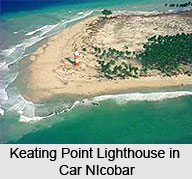
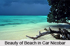
 Car Nicobar or Pu in the local language is the northernmost of the Nicobar Islands, which in turn are the southern part of the Indian union territory of the Andaman and Nicobar Islands. The Car Nicobar Island was ravaged by the 2004 tsunami. Car Nicobar Island falls in between Little Andaman and Nancowrie. The area south to the Ten-degree channel comes under Car Nicobar headquarter. It is a flat fertile island covered with cluster of coconut palms and enchanting beaches with a roaring sea all around.
The Car Nicobar is a very small Island, if compared with the Middle Andaman or South Andaman. The area of Car Nicobar Island is around 127 Sq km. There are clusters of 15 villages, which are inhabited areas, the largest being Malacca. The climate of Car Nicobar Island is tropical, as it is only 9 degree from the equator, with an annual rainfall of 400 mm. The data of past ten year shows that the mean relative humidity in the Car Nicobar Island is 79%, and the mean maximum temperatures is of 30.20 C, and mean minimum temperature is 23.00 C.
The soil analysis of Car Nicobar Island revealed high content of sand and clay hindering the growth of agricultural crops. The area of Car Nicobar is suitable for the plantation crops, and coconut and areca nut are the prime products, which are grown in the area.
 Although the area of Car Nicober is less than 7% of the area of the Nicobar group, in the census of 2001 its population was declared to be about 29,145 and more than half of the total Nicobar population.
The 15 villages of Car Nicobar Island include Mus, Kinmai, Small Lapathy, Big Lapathy, Tapoiming,Chukchucha, Kinyuka, Tamalu, Perka, Malacca, Kakana, Kimius, Arong, Sawai and Titop. Each village consists tuhet, meaning elderly heads, the number of which varies according to the size of the [Tuhet]. From each of these elders three are elected as 1st, 2nd, and 3rd captain, who look after the day-to-day affairs of the village. Direct administration of the Car Nicobar Island is performed by the Car Nicobar tehsil, a local administrative division of the Nicobar district. A tehsil is roughly corresponding to a county in its administrative powers.
Car Nicobar lies 750 km (465 miles) from the epicenter of the 2004 Indian Ocean earthquake, and the resultant tsunamis struck it with immense force and witnesses reported that the waves were as high as 30 ft (9 m). As of December 30, 2004, the number of casualties is actually unknown, but seemed likely to be high. One survivor told the Associated Press that there was not a single hut, which was standing. Most of the people went up to the hills and were afraid to come down.


