 Tawa Reservoir is in Hoshangabad District of Madhya Pradesh state. It is a large reservoir on the Tawa River in central India. The reservoir was created only after the construction of the Tawa Dam, which began in 1958 and was completed in 1978. While the construction of the reservoir, almost forty-four villages were submerged by the reservoir.
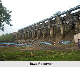
Tawa Reservoir is nestled between the western boundary of Satpura National Park and Bori Wildlife Sanctuary. The catchment area of Tawa Reservoir is 5982.9 km² and surface area is 225 km². Water Resources Department of Madhya Pradeshis responsible of maintaining the Tawa Reservoir. The reservoir is almost 1,815 metres long and 57.91 metres high. The location of Tawa Reservoir co ordinates 22 degree 33?40?North latitude and 77 degree 58?30?East longitude.
This article is a stub. You can enrich by adding more information to it. Send your Write Up to content@indianetzone.com
Tawa Reservoir
Tawa Reservoir is a large reservoir on the Tawa River in Hoshangabad District of Madhya Pradesh.


