The Darna River flows through an area of hydrographic soil. The Darna river co ordinates the latitude 19° 58` 0 N and the longitude 73° 57` 0 E. The Darna is one of the principal streams that join the Godavari in its course through the district are the Darna and the Kadva.
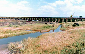 The Darna River rises from the peak of the Sahyadris that lies about a mile south of Igatpuri. It has a twisting course of more than fifty miles, though a straight line from its source to the Godavari that would not be more than thirty-five miles long. Its banks are like those of the Godavari below Nasik. This river however do not have great height, but are broken by several small streams, making the passage of the river very difficult to loaded carts.
A ferry at the junction of Chehedi is the navigation point to cross the river on the Nasik and Poona road, on the way to Sinnar. The riverbed of Darna is mostly wide and sandy. However, at times the water flows over rocks for miles together. The soil near the Darna River is hardly used for irrigation. At Belhu on the right bank, the river converges with the Kadva, which is a small deep stream that drains the whole of the south and southeast of Igatpuri. On the left bank the Darna river has only two tributaries of varied size, and they hold sparse water during the summer months. They are the Aundha and the Valdevi rivers. Both these rivers rise in the Anjaniri range, the former river atop a hill to the south of the fort, the latter from the summit of the fort itself. Both the rivers join the Darna near the ferry at Chehedi.
This article is a stub. You can enrich by adding more information to it. Send your Write Up to content@indianetzone.com


