 Godwar or Gorwar is a region in Rajasthan, which lies in the southwest Rajasthan and borders with the state of Gujarat.
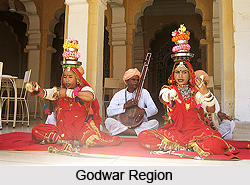
Location of Godwar
Godwar is situated on the western side of the Aravalli Range and cuts across Rajasthan from the southwest corner to the northeast. The highest peak of the Aravallis, Mount Abu is in this region.
History of Godwar
From the early 10th century the region was ruled by the Paramaras of Abu from the capital Chandravati. The first Paramar ruler of the area was Sindhuraja. In 1024, the kingdom was attacked and plundered by Mahmud Ghazni, when he passed through Rajasthan to attack Anhilwada. After defeating Prithviraj Chauhan III in 1192 AD, the Muslim Army also attacked Chandravati. In 1197 Qutubuddin Aibak general Khusrav defeated its king Dharavarsha near the foot of Mount Abu. In 1315, Godwar passed into hands of Deoras, a branch of the Chauhan clan of Rajputs. Deoraj, founder of the dynasty, claimed descent from Prithviraj Chauhan III, the last Hindu ruler of Delhi. In 1405, Rao Sobhaji founded the town of Shivpuri on the western slope of Siranwa Hill. Shivpuri today lies in ruins. In 1425, his son and successor, Sehastramal (or Sahastramal, Sehastramal), founded a fortress on the eastern slope of the same hill, which became his capital and grew into the present-day town of Sirohi. The capital was shifted to Sirohi around 1450. During the early years of the 19th century, Sirohi Kingdom suffered much from wars with Jodhpur and the Meena hill tribes of the area. The protection of the British was sought in 1817; the pretensions of Jodhpur to suzerainty over Sirohi were disallowed, and in 1823 a treaty was concluded with the British government. Sirohi became a self-governing princely state within British India, and part of the Rajputana Agency. For services rendered during the Revolt of 1857, the Rao received a remission of half his tribute. The state was traversed by the Rajputana Railway in the 19th century, and a station was built at Abu Road, 28 miles south of the town of Sirohi. Rao Keshri Singh (ruled 1875-1920) and his successors were granted the title Maharao (equivalent to Maharaja) in 1889.
Geography of Godwar
Godwar covers the region of Jalore, Sirohi and the southern portion of Pali districts of Rajasthan. The Sukri river and its tributaries flows through this region and flows in the west direction to join the Luni River before it evacuates into the Runn of Kutch. The West Banas River drains the south-eastern part of the region.
Climate of Godwar
The Aravalli Mountains helps in trapping the monsoon winds because of which the region receives a decent rainfall except for the Sirohi district. The region has an arid semi- desert climate and falls under the category of the North-western thorn scrub forests ecoregion. The western part of the Jalore district has a desert landscape as it falls in the Thar Desert. Abu Road and Sirohi are the prominent towns of the region.


