 Karimnagar district in Telangana is one of the few districts in the state endowed with vast natural resources both for agriculture and Industries. The district lies on the northern part of Andhra Pradesh approximately between the latitudes 18 degree and 19 degree and longitudes 78 degree. 30 minutes and 80 degree 31 minutes.
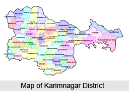
Location of Karimnagar District
The Northern and Eastern Boundary of the region is formed by the mighty Godavari River, separating it from the Adilabad district. In the South, the district is bounded by the Warangal district and the Medak district and in the North by the Adilabad district. The Nizamabad district lies to the West and the Baster district of Madhya Pradesh lies to the West. Apart from the Godavari, the other major river flowing through here is the Maniar River. The District comprises of 10 agriculture divisions consisting of 57 mandals, with a Geographical area of 11,823 Sq.Kms. This district has made rapid strides in agriculture production since the advent of Sree Rama Sagar Project (SRSP), which covers 35 mandals in the district.
Landforms of Karimnagar District
Soils of the district are predominantly sandy loam and red chelkas interspersed with B.C. Soils. The soils of the district in general are shallow with low fertility status except parts of Peddapalli, Manthani, Jagtial and Metpalli area and the soil along the banks of Godavari River and its tributary, Maniar. The soils exhibit a significant responsiveness to better management practices and balanced use of manures and fertilizers. In general the pH of the soil is found to be 7.5 to 8.5. The alkaline pockets are also identified under Chandragiri Vagu Project, Ayacut of Siricilla Mandal and also in the villages of Gagillapur, Dacharam, Thotapalli of Bejjanki Mandal, and in some pockets of Husnabad Mandal. The soil is low in its content of Organic carbon (less than 0.5%), phosphorous (less than 20kg/hect.) and zinc. It is generally medium to high in the available potash content.
 Forests of Karimnagar District
The forests in the district are grouped into two divisions, viz., Karimnagar East Division and Karimnagar West Division. The east division consists of four ranges viz. Azamnagar, Bupalle, Chintakani and Mahadevpur while the west forest contains five ranges viz. Jagtial, Raikal, Koidmial, Manthani and Siricilla. The forests of this district fall under Tropical dry deciduous and Tropical thorn forest types consisting of mixed teak and miscellaneous type of corporation.
Agriculture of Karimnagar District
Among the major crops found here are paddy, maize and jowar in cereals; green gram, red gram and Bengal gram in pulses; groundnut, sesamum, sunflower and castor in oilseeds and, cotton, chillies, turmeric, sugarcane and tobacco among others. The major irrigation project of the district is the Shriram Sagar Reservoir Project. Apart from this there are other medium projects such as the Shanigaram, Boggulavagu, Kalvala Project, Sripada Sagar Project and Flood Flow Canal.
Mineral Resources of Karimnagar District
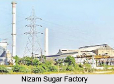
There is an abundance of mineral resources in the district. Major minerals found here include Coal, Lime Stone and Stowing Sand. Other minor minerals are Stone and metal, lime kankar, Granite (black and colour) and gravel. The bulk of the industries found here are based on agriculture, engineering, forest and mineral sectors and animal husbandry providing employment to a lot of people. These units are mostly consisting of rice mills, saw, oil, dhall and other grain mills, seed and other processing mills. Some important small sector industries are of general jobbing and engineering, manufacture of paper and tiles, stone dressing and crushing, cement concrete pipes, repairing of motor vehicles etc. The major industries in the district are National Thermal Power Corporation, at Ramagundam, Singareni Collories at Godavarihani and Nizam Sugar factory at Mutyampet.


