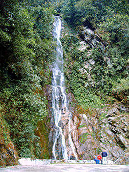
The west coastal lowlands, Western Ghats and southern parts of Assam experiences tropical monsoon rain forest type of climate. High temperatures throughout the year even in the hills characterize this type of climate. The rainfall in these areas is seasonal, but heavy and is usually above 200 cm a year. These regions experience most of the rain during the period from May to November, and are best suited for the growth of vegetation during the entire year. December to March is the dry months with very scanty rainfall. The heavy rain is responsible for the tropical wet forests in these regions, which consists of a large number of species of animals.
The areas with this kind of climate mainly lie in the sub-tropical belt due to significant variations in climatic elements. The climatic conditions are closely related with the atmospheric conditions of different parts of Indian sub-continent, which is controlled by a number of factors. Prevalence of atmospheric conditions in the Indian Ocean is due to the South-West monsoon that is developed and pushed towards the Tropical Zone by the cross-equatorial jet-stream of the Indian Ocean.
Topographic features of the Great Himalayan ranges of the East and `the Himalayan loops` that is situated on Indo-Tibetan and Indo-Burmese borders of the East (Hills of Barail, Naga, Patkai-Bum and Mishmi) also contribute to the causes of seasonal as well as aerial variation in micro-climatic elements in these regions. The surface winds in this belt are governed by high atmospheric pressure on the Indian Ocean and low pressure in the areas of the Greater Himalayas and very low pressure in the Western parts of the sub-continent during the summer season. This, cross equatorial jet stream moves ascending the foothill areas of the Arunachal Himalayas and pushes the sub-tropical jet stream northwards. Thus, climatologically front shifts occur in those areas of the state during summer. It creates tropical characteristics in the sub-tropical belt.
 These tropical monsoon rain forests are restricted along the south bank of the Brahmaputra River. It is termed as South Bank Tropical Wet Evergreen Dipterocarpus Forest and its altitude varies between 150 mts to 600 mts. The mean temperature ranges between 220 C to 360 C in summer and 100 C to 250 C in winter. The rainfall begins with pre-monsoon rains in March. It is followed by monsoons in May to its withdrawal during September, majority rainfall occurs during this period. The retreating monsoon and North East Monsoon also causes some rains in between. The total rainfall in this belt is in the range of 2500 mm to 3500 mm. There virtually exists no dry month in these areas.
The tourists who wish to enjoy the soothing atmosphere after witnessing the scorching heat and humidity of the plains love the climate of tropical monsoon rain forests. This factor has contributed largely to the tourism industry of the region.


