 Sabarmati River Front Development was mainly initiated in Ahmedabad, but presently the scheme is being followed all along the riverbanks. Ahmedabad is the seventh largest populous city of India and Commercial Capital of Gujarat State that lies on the banks of river Sabarmati. The city has unique identity owing to the River Sabarmati and Gandhi Ashram established on its western Bank. Sultan Ahmad Shah founded the city in 1411. The City covers an area of 190.84 Sq. Km. The River Sabarmati flows from north to south in the hub of the city and divides the city in almost two equal parts. The city encompasses the population of about 4.5 million. Ahmedabad experiences both hot and dry climate with scanty Rainfall. River Sabarmati is the backbone of the development of Urban Sprawl of Ahmedabad.
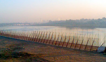
The riverfront is the most neglected aspect of the city and is characterized as an unimaginative and unplanned development in recent years. The river`s future to provide city level social infrastructure and recreation facilities are lying untapped for years. Though river Sabarmati is a major source of water for the city and in spite of the building of a major barrage to retain back water, except for a few months during the monsoon the river is dry.
The sewage contaminated storm water out-falls and the discarding of industrial waste poses a major health and environmental danger. Though the riverbanks and bed provide a place to stay and source of livelihood for many poor citizens, the riverbank slums are tragically flood prone and lack the essential infrastructure services. The slums situated along the riverbed also create a major obstruction to efficient management of monsoon floods in the river.
It has long been acknowledged that suitable development of the riverfront can turn the river into a key asset, which can progress the quality of environment and life in Ahmedabad and improve the competence of its infrastructure. In May 1997, the Ahmedabad Municipal Corporation founded the Sabarmati River Front Development Corporation Limited (SRFDCL) under Section 149 (3) of the Companies Act 1956. The SRFDCL was supplied with the basic capital of Rs. 1 crore and charged with the liability of developing the Sabarmati Riverfront. In August 1997, the SRFDCL appointed Environmental Planning Collaborative (EPC), which is a city based not for profit urban planning and urban development management consulting firm to prepare an all-inclusive proposal for the improvement of the Sabarmati Riverfront.


