 Land use pattern in India relates to the physical characteristics of land, the institutional and other resources framework like labour, capital available. All these aspects are associated with the economic development. India has a total land area of approximately 328 million hectares. Mostly, land utilisation statistics are obtainable for almost 93 % of the entire area that is around 306 million hectares. It is considerable to note that every forefather over the past 8,000 years or so have been successful in harbouring nearly 140 million hectares of land from the natural ecosystem to agriculture. From the time of independence, people have been successful to add another 22 million hectares. As a result, 162 million hectares of land excels as the net sown area at present. It forms a stupendous percentage of as high as 51%. No other large country is as fortunate as India in this regard.
Reporting and Non-Reporting Land
The land for which the data on classification of land-use is available is known as Reporting Land. In some cases the reporting land is that land, where the land use pattern figures are supported on land records and are based on village records or papers. These records are preserved by village revenue agency and here the data is completely based on details of entire areas. In cases, where the records are not preserved, the estimates are mostly based on sample survey. Thus, the statistics of land use pattern are based on these two methods. On the other hand, the lands where no data is available are known as Non-Reporting Lands.
Uncultivated Land
According to the available land use statistics, there has been a slight increase in the net sown area. Almost 28 million hectares have been added over the passing few decades. Around 1.3 % of the land is under fruit trees. Nearly 5 % of the land falls in the category of uncultivated land which is cultivated once every 2 to 3 years. Thus, near about 51% of the whole area, on an average, is cultivated once a year. The uncultivated lands are subsidiary lands and are kept so to re-establish their richness. Its use depends upon high-quality and timely rains also.
Pastures and other Grazing Lands
The area separated as cultivable waste, has remained stationary at around 6.4 % for several decades. The land under permanent pastures is despondently low and suggests a remarkable population pressure on the land. Also, credit must be confirmed on the farmers that with so modest land under pastures, they have the biggest number of cattle. They are nurtured mainly on husk, grain chaff, farm waste and few fodder crops. This is definitely the most economical way to have a larger number of drought animals and bovine cattle. Areas that have been classed under forests are also used for cattle grazing.
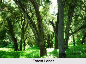
Forested land in India is far less in scientific norm. For a self-sufficient economy and accurate ecological steadiness, at least one third of the total land area must be kept under forests and natural vegetation. In India, it is as low as 19.27%. Photographic proof, gained from satellites has confirmed that only about 46 million hectares come under real forests, as opposed to the estimated 63 million hectares, according to the figures of land use pattern. However, this outline establishes a tiny rise from 40 million hectares.
Forest Lands
It is important for the populace to ensure that they increase the area under forests for reasons more than one. A bigger area under forests is an obligation, to maintain the ecological balance and for absorption of carbon dioxide, the assemblage of which is likely to heighten the green house effect. This in turn would raise atmospheric temperature at the global stage. It may lead to thawing of ice caps and equivalent rise in sea level, jeopardising low-lying densely populated parts of the world. Forests supply home to wildlife and help their continuation. They help in enhancing the level of rainfall, minimising cases of famine. Forested lands also help in permeation of rainwater in the subsoil and modulating the flow of river waters in both rainy and dry seasons. Forests safeguard not only water but soil as well. They, thus, help in plunging the volume of floodwaters and their ferocity.
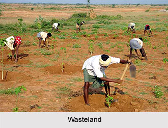 Wasteland
A part of the land that is not utilised for the moment is classified as wasteland. This embraces the baked and rocky deserts. High mountainous and uneven lands also fall into this category. At times humankind has also been responsible to add to such areas by deforestation and overgrazing.
Measures for proper Land Use
The mounting population and advanced standards of living have resulted in an ever increasing demand for residential land, both in villages and towns. Cities and towns are obligated to grow vertically rather than horizontally. Land is needed to develop industry, commerce, transport and recreational facilities. In view of mounting pressure on land for numerous purposes, it is customary to plan appropriate use of all the obtainable land. This may be done by following fitting measures to control soil erosion, desertification etc. which turns cultivatable land into wildernesses. In addition, some of the barrens may be brought around for different uses. Likewise, with the help of up-to-date and scientific methods of farming, productivity of land can also be amplified. All endeavours should be made to strike a balance amongst diverse use of land.
In India the capacity for expansion of cultivation to further new areas is very restricted. As of now, 49% of the entire reporting land is cultured. Fallow and other waste lands, including grazing pastures, which are not currently cultivated, is presumed around 42 million hectares, and further expansion of cultivation to such lands would be expensive as improvements should be made on irrigation and water and soil conservation.
In the dynamic context, keeping in view the natural endowments and the recent advances in technology, the overall interests of a country may dictate a certain modification of or a change in the existing land-use pattern of a region. A proper study of the present land-use patterns and the developing trends will help to suggest the scope for planned shifts in the patterns in India.


