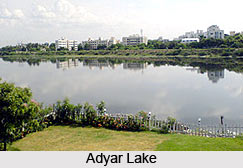
 The Adyar River originates from the Chembarambakkam Lake in Chengalpattu district, is one of the two rivers which winds through Chennai, Tamil Nadu and joins the Bay of Bengal at the Adyar Estuary. The Adyar Estuary is rich in flora and fauna. The 42km long river contributes to the estuarine ecosystem of Chennai. Despite the high pollution levels, boating and fishing take place in this river. The river collects surplus water from about 200 tanks and lakes, small streams and the rainwater drains in the city, with a combined catchment area of 860 sqkm. Most of the waste from the city is drained into this river.
Origin and Course of Adyar River
Adyar River starts from Malaipattu tank near Manimangalam village in Chennai. It starts to appear as a stream only from the point where water from Chembarambakkam Lake joins the river. It flows through Kanchipuram, Tiruvallur and Chennai district for about 42 km before joining the Bay of Bengal in Adyar, Chennai. Here it forms an estuary, which extends from the Adyar Bridge to the sandbar at the edge of the sea, with some small islets in-between. The estuary attracts a wide variety of birds. The estuary covering an area of about 300 acres was made a protected wildlife reserve in 1987.
The river forms a backwater near the mouth, known as the Adyar creek, due to the formation of sand bar at the mouth. This creek is a natural channel which carries tidal water back into the sea.
Ecology of Adyar River
Adyar Estuary and Creek and the Theosophical Society on the Estuary"s southern side have been a shelter for migratory and resident birds for years. The environmental conditions in the estuary with low salinity, good shelters and high plankton availability in the Adyar creek serves as a good nursery for fish. The flow of tidal water allows easy travel for boats. However, with the city"s sewage and contamination from its various industries emptying into the river water, the biological activities in the region was affected. Although the number has been reduced due to pollution, they still attract hundreds of birds.
Bridge on Adyar River
The Thiru Vi Ka Bridge was constructed in October 1973. It is a four-laned bridge measuring 312m long and 19m wide. During the time of its inauguration, the bridge had separate lanes for cyclists and footpaths for pedestrians. The bridge was damaged in November 1985 due to a rush of flood water, resulting in the suspension of vehicular traffic over the bridge. The bridge was meant for other, slow-moving traffic across the river. However, the bridge was severely damaged during a cyclone between 1876 and 1878.


