 West Singhbhum District is one of the oldest districts of Jharkhand. After the British invasion of Kolahan in 1837, a new district was consequently constituted to be known as Singhbhum with Chaibasa as its administrative headquarter. Subsequently three districts namely East Singhbhum District, West Singhbhum and Saraikela - Kharsawan (Princely State of Kharsawan) have been carved out of erstwhile Singhbhum District and Chaibasa is the headquarter of West Singhbhum. West Singhbhum District forms the southern part of Jharkhand and is the largest district in the state.
Location of West Singhbhum District
West Singhbhum District is located between 21 degree 58 minutes and 23 degree 36 minutes north latitude and 85 degree and 86 degree 54 minutes east longitude. The district is situated at a height of 244 metres above the sea level and has an area of 5351.41 sq kms. The district is bounded in the north by Khunti District, in the east by Saraikela-Kharsawan district, in the south by Keonjhar, Mayurbhanj District and Sundargarh district of Orissa and in the west by the Simdega District and Sundargarh District (in Orissa).
History of West Singhbhum District
West Singhbhum District came into existence when the old Singhbhum District bifurcated in 1990. With nine Community Development Blocks, eastern part became the East Singhbhum District with Jamshedpur as its district headquarters and with remaining 23 Community Development Blocks, West Singhbhum District with Chaibasa as its district headquarters was formed. In 2001 West Singhbhum District was again divided in two parts. At present, West Singhbhum District comprises 15 blocks and two administrative sub-divisions. There are two accounts relating to the origin of the name of the district. According to one legend, the name Singhbhum (meaning lands of `Singhs`) has been derived from the patronymic of the Singh Rajas of Porahat. The second account suggests that the name is an altered form of the `Singhbonga` the principal deity of tribal population of the district.
Geography of West Singhbhum District
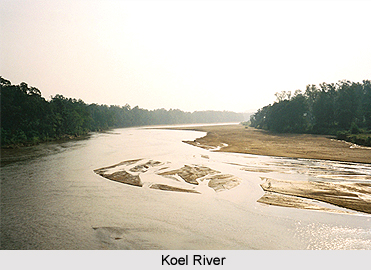
West Singhbhum District is full of hills alternating with valleys, steep mountains, and deep forests on the mountain slopes. Some of the rivers of the West Singhbhum Distric are Koel River, Karo-Koina, Kharkai, Sanjai, Raro, Deo and Baitarini. The climate of the district is divided into three seasons; winter from November to February, summer season from March to May and the rainy season from June to October. The cold season is delightful while it is unpleasantly hot in the summer season with hot winds prevailing. On account of the barrier of hills in the southeast, the atmosphere is generally dry. The district receives heavy rainfall between July and August. Annual average rainfall in the district is about 1422 mm. Monsoon generally breaks in the second week of June.
Demography of West Singhbhum District
According to the 2011 census, West Singhbhum district has a population of 1,501,619. The West Singhbhum district has a population density of 209 inhabitants per square kilometers. Its population growth rate over the decade 2001-2011 was 21.69 percent. West Singhbhum District has a sex ratio of 1004 females for every 1000 males. The literacy rate of this district is 59.54 percent.
Economy of West Singhbhum District
The majority of the population of West Singhbhum consists of tribals people. The greater part of West Singhbhum District is covered by the iron-ore series. West Singhbhum District is rich in natural resources. These are mostly either minerals or forest produce. Several minerals are found in the district such as Chromites, Magnetite, Manganese, Kainite, Lime Stone, Iron Ore, Asbestos and Soap-stone. The soil of the district has been classified into three groups namely Rocky Soil, Red Soil and Regur Soil. Rocky soil is found mostly in the southern, western and north-western portions of the district. It remains practically uncultivated. Red soil is spread throughout the district. It is sandy and loamy and has poor fertility. Black soil is mostly found in the lowlands of Kolhan. The texture of soil is loamy and clayey. It is very fertile. Rice is the main crop of the district.
After division of Singhbhum District into three parts, West Singhbhum District remains almost nil in industrial activities.


