 Sagara is the hilly city and the station located in Karnataka. It is also a sub divisional and a taluk headquarters.
Location of Sagara
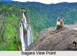
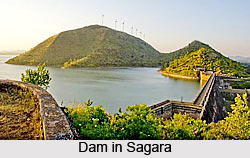
Sagara is located in the Western Ghats Mountain Range in India. It is known for its proximity to Jog Falls and to the historical places of Ikkeri, Keladi and Varadamoola. The river Varada originates near Sagara. Sagara subdivision consists of Sagara, Soraba, Hosanagara and Shikaripur taluks.
Administration of Sagara
Sagara city is one of the 74 Karnataka Municipal Reforms Project (KMRP) city in Karnataka. Sagara ULB was started in 1931 and became a City Municipal Council (CMC) grade two in the year 2007. The ULB consist of 31 wards with the respective number of councillors.
Demography of Sagara
According to the Population Census in the year 2001, Sagara had a population of 50,115. Males constituted 50% of the population and females 50%. Sagar had an average literacy rate of 79%, higher than the national average of 59.5%. Male literacy rate was 82%, and female literacy rate was 75%. In Sagar, 11% of the population was under 6 years of age.
 At the 2011 census its population exceeded 54,550. The population of Sagara was 54,550 at the 2011 census and total area is 19.71 sq. km.
Derivation of Sagara
Sagara derives its name from Sadashiva Sagar, which is a lake. Sadashiva Nayaka, ruler of Keladi dynasty built a lake in between Keladi and Ikkeri. Sadashiva Sagar is now called Ganapathi Kere (Ganapathi Lake). It is a sub-divisional headquarters headed by a sub-divisional magistrate.
Economy of Sagara
The economy of Sagara is mainly driven by areca nut (betel nut), paddy, spice and forest products trade. Betel nut is the major cash crop grown in the area. Along with areca nut, spices like pepper, clove, cinnamon, nutmeg, and cocoa are grown. The economy of the city is highly volatile and is dependent on the variation in the pricing of these agricultural products. Sagara APMC is one of the main markets for areca nut in Karnataka.
 Sagara has a relatively high number of Gudigar families that for generations have been engaged in sandalwood and ivory carving. The Gudigar men make idols, figurines and knickknacks like penholders, agarbathi stands, cuff links, photo frames and paper clips; the women are adept at making garlands and wreaths out of thin layers of scraped sandalwood.
Visiting Information
Sagara has its own railway station. The train station is known as Sagar Jambagaru and there are trains that connect Sagara with Bangalore and Mysore and a passenger train between Shimoga to Talguppa passes through Sagara. The nearest airport is Hubli Airport, which is about 159 km from Sagara.