
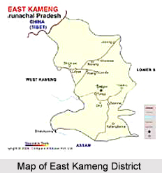
 East Kameng district of Arunachal Pradesh is located in the distant northeastern region of India. This district in the north shares an international border with Tibet. East Kameng district also shares its border with the neighbouring state of Assam and with other districts such as Papum pare District, West Kameng District and Kurung Kumey District. This district of Arunachal Pradesh is rich with culture and tradition. The entire East Kameng district, apart from a small area on the southern most section bordering Assam, is hilly.
East Kameng District
East Kameng district is a beautiful district of Arunachal Pradesh. A major portion the district is mountainous that adds to its natural charm and beauty.
Introduction
East Kameng district of Arunachal Pradesh is located in the distant northeastern region of India. This district in the north shares an international border with Tibet. East Kameng district also shares its border with the neighbouring state of Assam and with other districts such as Papum pare District, West Kameng District and Kurung Kumey District. This district of Arunachal Pradesh is rich with culture and tradition. The entire East Kameng district, apart from a small area on the southern most section bordering Assam, is hilly.History of East Kameng District
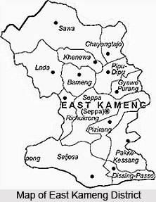 History of East Kameng district narrates the course of events that led to the formation of the district. East Kameng district was formed by the house-listing operation of the census of 1981. According to Re-organisation of District Act, 1980, Kameng district was categorized into two districts namely West Kameng and East Kameng. Seppa is the district headquarters of East Kameng district and was the sub divisional head quarters of the former of Kameng district. The district is further divided into two subdivisions namely Chayengtajo and Seppa.
The name Kameng has been derived from a tributary of the Brahmaputra River, known as Kameng River. The district was initially a part of Darrang district, Assam, till the year 1914. By a Government of India Notification of 1914, the area of this district was made a part of the "western section" of the `North East Frontier Tract`. In the year 1919 the region under the Balipara Frontier Tract was categorized into Subansiri Area and Sela-Agency. Sela Sub-Agency was renamed in 1954 as the Kameng Frontier Division. The headquarters was shifted to Bomdila. This division was again renamed as Kameng district in 1965. The district underwent bifurcation in May 1980 into East Kameng district and West Kameng district.
In 1971, the area under this district was under the North East Frontier Agency, which in turn was constitutionally a part of Assam. The administration of this agency was controlled by the President of India through the Governor of Assam. In the year 1972, the agency was converted into a Union Territory and was named as Arunachal Pradesh. The administration of Arunachal Pradesh was then assigned to a Chief Commissioner and Shillong was made the head quarters. Legislative Assembly was formed in this Union Territory on 15th of August 1975 which comprised of the Chief Minister, Lt. Governor appointed as the Chief Administrator and a cabinet of four ministers to assist him. The headquarters was then shifted to Itanagar in Lower Subansiri district.
Panchayat Raj was introduced under the Panchayat Raj Regulation, 1967, in the East Kameng district. As per the regulation, at the village level Gram Sabhas were formed, at the block level Anchal Samities existed, at district level Zilla Parishad operated and at the Agency level the Agency Council existed. However, after the formation of the Legislative Assembly the Agency Council lost its identity.
The administrative responsibility of Seppa subdivision of East Kameng district is assigned to the Deputy Commissioner General who is under the authority of an Additional Deputy Commissioner. The entire administration of the district is controlled by the Deputy Commissioner. The lowest unit of the administrative machinery of the East Kameng district is known as a `circle` which is taken care of by a Circle Officer. Presently the district has 13 circles. By definition, a circle is a group of villages. Traditional village councils are the customary administrative system of the villages. The village councils have the authority to settle all civil and some criminal cases that falls within their jurisdiction and this authority has been granted by the Assam Frontier Regulation, 1945. The Deputy Commissioner has also been granted the powers of session`s judges whereas some officers have been given magisterial powers. The Arunachal Police also assists the authorities of the district in the maintenance of law and order. Since its formation the district has been dominated by the scheduled tribes of the state of Arunachal Pradesh.
Geography of East Kameng District
 Geography of East Kameng district exhibits great variations. The district is located at the western part of the state of Arunachal Pradesh. It is situated at the eastern end of West Kameng district. It lies between 920 36` to 930 24` East longitude and 260 56` to 270 59` North latitude. Papum Pare district along with certain parts of Kurung Kumey district surrounds the eastern part of the district whereas Sonitpur district of Assam surrounds its southern part. In the west, the district is bordered by West Kameng district and its northern part is surrounded by a part of Kurung Kumey district and Mac Mohan line. Geographically, the district occupies an area of 4,134 square kilometres.
Topography of East Kameng District
Mountains and deep gorges form the inter district barriers. East Kameng district has also a number of narrow valleys that gradually open up into wide ones. Agriculture is permanently practiced in this region. The district acts as an extension of north east India towards Himalayan ranges.
Rivers of East Kameng District
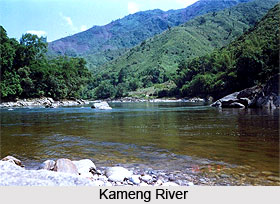
The name of the erstwhile district Kameng was derived from a tributary of the mighty river Bramahputra, named Kameng River. The river originates from the glacial lakes situated below "Gorichan". It flows through East Kameng district and reaches to the plain of Assam. In the Sonitpur district of Assam, the river once again joins the Bramahputra River. Other significant rivers of East Kameng district include Pakke (I), Pakke (II), Papu-Para, Bishom, Pachuk, Pachi, Pacha and Dibru. They all are the tributaries of Kameng River and are not navigable.
Climate of East Kameng District
The district of East Kameng has a variety of topography which causes substantial differences in the climatic conditions of different region of the district. Even within short distances, the climate greatly varies. Various administrative centres of the districts possess different altitudes ranging from 363 metres to 1906 metres. In the northern part of the district arid climate is prevalent in its tundra region whereas cool temperate and humid subtropical climate is found in the southern region which comprises sub-Himalayan hills. During summers, the district receives abundant rainfall whereas during winters it experiences extreme cold. Due to heavy rainfall during monsoons, most of the streams and rivers of the district gets flooded, which often hamper the transportation and communication systems of the district. Frequent landslides are also evident in East Kameng district which makes the maintenance of roadways quite expensive. Owing to this, a number of developmental activities are also held during the monsoons. Intensified developmental work can be observed between the months of October and March.
Demography of East Kameng District
The chief tribes inhabiting the East Kameng district are Bangnis (Nyishi), Akas, Miji Tribe and Puroiks (Sulung). Each tribe has their own dialects, customs, and religion. The Bangnis tribe who are also called Nishi, Nishang, Nissi or Dafla and Sullungs inhabit the area contagious to the North Eastern Kameng extending up to Lower Subansiri district. The Akas inhibit the Bana Area and Mijis inhibit to the region eastern of West Kameng district. According to the Population Census in the year 2011, the East Kameng district has a population of 78,413. The East Kameng district has a population density of 19 inhabitants per square kilometre. Its population growth rate over the decade 2001-2011 was 37.14%. The East Kameng district has a sex ratio of 1,012 females for every 1,000 males. The literacy rate of the East Kamreng District is 62.48%. Since independence, much of the population of East Kameng district has relocated to the district capital, Seppa. With the coming of modernism, festivals such as the Sarok of the Aka, Nyokum of the Nishi, Jonglam-Ponklam and Chindang of the Miji Tribe and the Gumkum-Gumpa are celebrated in full flair in Seppa.
Culture of East Kameng District
In Kameng district, social and cultural events are very closely associated with the life, environment and other relevant activities of the people residing here. Bangnis is one of the main tribes of East Kameng district. The marriage of the Bangnis takes place through the process of formal negotiations between the parents of both parties. After a specific bride price payment, the girl comes to live with the husband. Moreover, there are no formal ceremonies, which mark the consummation of marriage in this community. The people here wear a number of ornaments. Polygamy is very common among the people of this tribe. The Sulungs (Puroiks) are a very scattered tribe in this district. The Sulung society is based on the unit of village community. The Sulungs own land but in some cases they are dependent upon their Bangni landlords. The chief festival of the Bangnis is Nyokum Yullo which is celebrated in February. The site where the festival is performed is called Nyokum Kyageng. The Sulungs celebrate Gumkum Gumpa generally in April.
Economy of East Kameng District
Agriculture is the main occupation of the people of East Kameng district. Jhum cultivation is prevalent in this district; however, it is being slowly replaced by permanent cultivation. The main crops of the district are Paddy, Maize, Millets, Sweet-Potato, Chilly and Vegetables. Funds were provided for rural agriculture and other fish Culture activities. Horticulture is also becoming more and more popular.
Tourism In East Kameng District
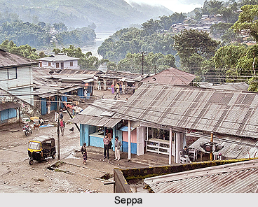 Tourism in East Kameng district is really popular and worthwhile as this district offers a number of sightseeing and exploring opportunities. There are three chief valleys in this district namely Pakke-Valley, Pappu Valley and Passa Valley. These places are worth seeing. The indirect rivers make them more beautiful. On both sides of the rivers paddy fields are grown. Lumdung or Passa valley is famous for wandering birds during the winter season. During summer season, the valleys become green with natural beauty. Lumdung-Pappu Valley comes under Seppa Block, Passa and Pakke Valley come under Pakke-Kessang Block headquarter, Pakke-Kessang, is situated in Pakke-Valley. Lumdung (Pappu) is 21 kms, Passa (Rilloh) is 78 kms and Pakke is 140 kms from Seppa, the district headquarters. Pakke-Kessang is a cold place, so it is advised to carry warm clothes while travelling.
Pakhui Tiger Reserve is another most popular tourist spots at East Kameng district under Seijosa Circle. It is 64 kms from Tezpur and 225 kms from Seppa, the district headquarters. The major hill stations of East Kameng district are Bameng, Chayangtajo and Pakke-Kessang. They are situated at 48 kms, 81 kms and 141 kms respectively from Seppa. Chayangtajo is famous for `Gorichen`, the snow peaked Mountain that can also be seen from Bameng. During the winter season, Kameng River is considered as a good spot for angling and fishing. Those who are interested in indulging in these activities need to take permission from the district administration.
Further, Seppa, which is the capital, generally hosts several beautiful tribal dance festivals. These amazing dance festivals are simply amazing and they add colours to the scenic natural countryside. The tourists can also get a look of the beautiful Himalaya Mountains from the hill stations of Bameng, Chayangtajo and Pakke-Kessang. East Kameng district can be described as a wonderful and worthwhile tourist destination of the north-east region of India.
Pakke Kessang :
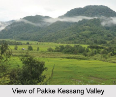 Pakke Kessang is a town located in the Indian state of Arunachal Pradesh. The town has been carved out of the East Kameng District of the state along with five administrative units, which are Pakke-Kessang, Seijosa, Pijiriang, Passa Valley, and Dassing-Passo with district headquarters at Lemmi. Pakke Kessang is located 90 km north of East Kameng District and 190 km east of Itanagar. It is one of the 60 constituencies of the Legislative Assembly of Arunachal Pradesh. Papum Reserve Forest is located in this Pakke Kessang valley.
Recently updated articles in States of India

Bandare Waterfalls, Meghalaya
Bandare Waterfalls in South Garo Hills, Meghalaya, is a secluded natural attraction surrounded by dense subtropical forests and rugged mountain terrai...

History of Thissur District
Early History of Thissur District explains flourishing of the port cities. Now these port cities are transformed into archaeological sites.

Tippi Orchid Research Centre, Arunachal Pradesh
Tippi Orchid Research Centre in Arunachal Pradesh is renowned for its rich collection of exotic and endangered orchids. Surrounded by lush rainforest...

Tourism in Nashik District
Pilgrimage tourism in Nashik district involves visiting the various places of Hindu and Jain worship located here. Some of the holiest sites for Hind...

Mangadu, Kerala
Mangadu in Kerala’s Kollam district is a significant megalithic site known for its urn burials, cist burials, menhirs, and stone circles. Excavations...
Related articles in States of India

East Indian States
East Indian States comprises of Bihar, Jharkhand, West Bengal, Odisha and also the Union Territory of Andaman and Nicobar Islands. It defines the cult...

Purnia District in Bihar
Purnia District is located in Bihar and extends from River Ganga to Nepal. The district has a rich Hindu history and glorious past.

Hooghly district
Hooghly District along the bank of the river Hooghly is one of the principal trading ports of West Bengal.

Geography Of Chittoor District
Geography of Chittoor district is spread along the topography of the land which is divided into two natural divisions; Chittoor has a dry and healthy...

Districts of West Bihar
Districts of West Bihar is comprised of medieval monuments that were built by the different governors of Mughal era.