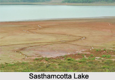
 Kollam District is situated on the south west coast of Kerala. It is bounded on the north by the Alappuzha district, and on the north east by the Pathanamthitta district. To the east lies the Tirunelveli district of Tamil Nadu and to the south lies Thiruvananthapuram district. The western side of the district is bordered by the Arabian Sea. There are two major rivers flowing through the district, namely the Kallada and the Ithikkara. The Sasthamcotta Lake, the only major fresh water lake in the state is in Kollam District. The district covers a total area of 2491 Sq. Kms.
The district has a tropical humid climate with an oppressive summer and plenty of seasonal rainfall. The hot season, lasting from March to May is followed by the South West Monsoon from June to September. The rest of the year is generally dry. The average annual rainfall here is around 270 cms. The mean maximum temperature of the place is around 36 degree Celsius, and the mean minimum temperature is 22.4 degree Celsius. There are three main soil types found in the district. These are- sandy loams, laterite soil and forest soil. Sandy loams are found along the coastal belt, and the forest soil is found in the eastern forest belt. The rest of the district has laterite soil. Kollam district has a large area under forest.
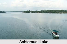
Pathanapuram, Anchal, Kottarakkara and Chadayamangalam are blocks having large areas of forest. The forest divisions are at Thenmala and Punalur. The district is quite rich in mineral resources. The beach sands of the district have concentrations of heavy minerals like Ilmenite, Rutile, Monosite and Zircon which offer scope of exploitation for industrial purposes. There are large deposits of China clay in Kundara, Mulavana and Chathannoor and lime shell deposits in Ashtamudi Lake.
 Bauxite deposits are found at Adichanallur and disseminated graphite in Punalur.
Agriculture is the most important economic activity in the village. About 70 percent of the work force is engaged in agriculture. The total area of land under cultivation is around 2, 18,267 hectares. The major crops grown here are paddy, tapioca, coconut, rubber, pepper, banana, mango and cashew. Among the various crops grown here, the major ones are- paddy, tapioca, coconut, rubber, pepper, all of which cover an area of 1,73,847 hectares. Coconut gardens extend to about 75,454 hectares. Small and marginal farmers constitute more than 95 percent of the farming community and the average per family holding is 0.21 hectare.
Kollam also occupies a fairly important place in the trade and commerce scenario of the state. It is the centre of the country`s cashew trading and processing industry. It is also an important hub for the state`s marine products industry, with the port of Neendakara being the centre for trawlers and ice plants.
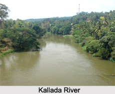 With two rivers, the district is endowed with perennial supply of water. In order to augment the irrigation potential, several plans were evolved during 1953 to undertake river basin schemes. Kallada Irrigation Project, the biggest multipurpose project, undertaken by the State Government, is intended to utilise the water of Kallada River, mainly for irrigation purposes in Kollam, Pathanamthitta and Alappuzha districts. There is also a proposal to generate 50 M.W. of electricity from the dam at Thenmala.
While major and medium irrigation schemes are being taken up by the State Government directly, individual minor irrigation schemes, viz., dug-wells, bore-wells, tube- wells, pump sets, drip and sprinkler irrigation systems are being financed by commercial co-operative banks.


