
Khagaria District
History of Khagaria District reveals that this district was initially a part of Munger District. It was a sub-division of Munger District and became an independent district in 1981.
Introduction
Khagaria District is an administrative district of Bihar and has its headquarters at Khagaria. Khagaria District is located between longitude 25 degree 15 minutes to 25 degree 44 minutes and latitude 86 degree 17.14 minutes to 86 degree 52.5 minutes. Total area occupied by this district is 1485.8 sq kms. Khagaria District is bounded by Saharsa District in its north, by Munger District and Begusarai Districts in its south, by Bhagalpur and Madhepura Districts in the east and by Begusarai District and Samastipur District in its west. Khagaria was part of Munger Sadar Subdivision till 1943. In the year of 1944, it was constituted into a separate subdivision. In the year 1959, Khagaria subdivision had one sub-divisional officer, one Land Revenue Deputy Collector, one sub-deputy collector, one sub-deputy magistrate and 6 Anchal Adhikaris and Block Development Officers. At that time, the six blocks were Alauli, Khagaria, Chautham, Gogari, Parvatta and Simari-Bakhtiarpur. Khagaria was made a separate district in the year 1981, with one subdivision and six Community Development Blocks. Presently, Khagaria consists of two sub-divisions and seven Community Development Blocks.
History of Khagaria District
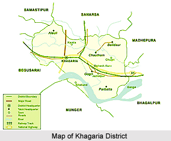 History of Khagaria District is not very old. Earlier, it was a part of Munger District, as a sub-division. The sub-division of Khagaria was created in the year 1943-44. It was upgraded as a district in the year 1981 under the notification of state government. As a sub-division of Munger District, Khagaria was the youngest, in terms of creation of sub-division, before independence of the country. The other three sub-divisions were Munger sadar, Begusarai and Jamui district. Jamui sub-division was created on 22nd of July 1864 and Begusarai sub-division on 14th of February 1870.
Early history of Khagaria District states that the territory formed part of the region of Aryan settlers. Historical accounts also state that Munger came into prominence, in the year 1762, when Kasim Ali Khan made it his capital instead of Murshidabad district. Further, with the extension of the British dominions, Munger ceased to be an important frontier post. The existence of Munger, as a separate executive centre is believed to exist since the year 1812. The subdivision of Jamui was formed in the year 1864, Begusarai sub-division was established in 1870 and in 1943-44 Khagaria subdivision was established with headquarters at Khagaria. Khagaria was created as a separate sub-division mainly because of the difficulties arising out of a lack of easy means of communications.
History of Khagaria District is not very old. Earlier, it was a part of Munger District, as a sub-division. The sub-division of Khagaria was created in the year 1943-44. It was upgraded as a district in the year 1981 under the notification of state government. As a sub-division of Munger District, Khagaria was the youngest, in terms of creation of sub-division, before independence of the country. The other three sub-divisions were Munger sadar, Begusarai and Jamui district. Jamui sub-division was created on 22nd of July 1864 and Begusarai sub-division on 14th of February 1870.
Early history of Khagaria District states that the territory formed part of the region of Aryan settlers. Historical accounts also state that Munger came into prominence, in the year 1762, when Kasim Ali Khan made it his capital instead of Murshidabad district. Further, with the extension of the British dominions, Munger ceased to be an important frontier post. The existence of Munger, as a separate executive centre is believed to exist since the year 1812. The subdivision of Jamui was formed in the year 1864, Begusarai sub-division was established in 1870 and in 1943-44 Khagaria subdivision was established with headquarters at Khagaria. Khagaria was created as a separate sub-division mainly because of the difficulties arising out of a lack of easy means of communications.Geography of Khagaria District
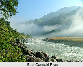 Geography of Khagaria District spreads over vast tracts of flat alluvial plain and swampy lands. The northern part of the district is an extensive plain formed by the rich alluvial soil. The southern portion of Khagaria District consists of vast rice tracts and forests. The major part of the alluvial plain is inundated during the rains by the over flow of the rivers. However, the inundation has slightly decreased after construction of embankments but still a large part in the north eastern part of the district. The principal rivers of the district are Ganga River, Budhi Gandak River, the Bagmati River, the Kamla River and the Ghaghri (the mainstream of Kosi). The Ganga forms the southern boundary of Khagaria District.
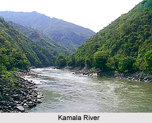
Budhi Gandak River runs a criss-cross course through the district of Begusarai and enters Khagaria for a short while. It forms the western boundary of the Khagaria town and a protection embankment built along the eastern side of this river, protects Khagaria town from the floods caused by Budhi Gandak. Bagmati enters the district from the western side, through Begusarai. Kamla River enters the district from Darbhanga, near Mohraghat. It then flows south east to Chautham, merges into Bagmati, and the united stream flows into the district of Bhagalpur under the name of the Ghaghri, which is known as one of the main branches of the Kosi River.
 Geography of Khagaria District is characterized by a moderate climate. The climate of the district is medium between the dry, parching heat of northern part of the country and the close moist atmosphere of the south valley of Bengal. The heat is often intense but is very favourable during the rains because of low humidity. The seasons are the same as in the other parts of Bihar. The summer begins towards the middle of March and continues up to the end of June, when the rainy season begins. The rainy season continues up to October, while the water logging due to rainwater continues in some areas up to the end of December. The winters are quite pleasant in this area.
In contrast to the southern portions of the old district of Munger, this district, lying north to Ganga does not comprise any forest of Sal or other large trees. At most of the places, there are luxuriant gardens of mango and litchi, for which this district is mostly famous. Apart from these, Babul, Neem, Sirish and Sisho are also found. Wild animals, such as boars were occasionally found in the northern area of Khagaria District. During the winters, migratory birds come in large numbers in the northern part of the district. In Khagaria District there is no hill and no mineral is found in this district.
Demography of Khagaria District
 According to 2011 Census Khagaria District had population of 1,657,599 of which male and female were 880,065 and 777,534 respectively. The average literacy rate of Khagaria in 2011 was 60.87 percent compared to 41.35 percent of 2001. If things are looked out at gender wise, the male and female literacy rate was 68.51 and 52.16 respectively. The total literates in Khagaria District were 797,784 of which male and female were 478,545 and 319,239 respectively.
Economy of Khagaria District
The economy of the district is dependent entirely on agriculture and its two main allied activities, namely horticulture and dairy. Industrialization is completely absent in Khagaria District. This district has potential for agro based industries because of large production of banana and maize, but so far no industry has come-up. Due to the abundance of milk cattle in this area, sale of milk and milk-product, especially ghee is also an important business activity here. This has been a traditional occupation of this area. Rearing of cattle had been a traditional occupation in this area. Trade and commerce are the only non-agricultural economic activity in Khagaria District. Khagaria and Gogri Jamalpur are the two important trade centres. Main trading item is food grains.
Culture of Khagaria District
Culturally, this district has tradition of Melas, usually held on several occasions particularly in Dussehra and Diwali. Old tradition of mela continues in Katyani Asthan, a place in Choutham Block. Another old traditional mela is Gopastami Mela, held just after Chath in the month of Kartika, near Goshala, Khagaria.
Tourism in Khagaria District
Khagaria does not have places of historical importance. Yet there are certain places, which have religious importance. The main tourism attractions of this district are -
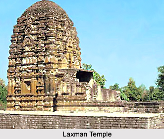
Katyayani Asthan: Katyayani Asthan is situated at a distance of approximately 12 kms from the District headquarters, on the bank of Kosi River. Temples of Lord Rama and Lord Laxmana are situated at this place.
Ajgaibinath Mahadeo: This place though currently, in Sultanganj of Bhagalpur District, is very near to Aguanighat of Khagaria District and the temple of Lord Shiva on a hillock has traditionally been a centre of attraction for devotees.
Khagaria District is well connected to other parts of Bihar and the country through railways as well as roadways. New Delhi - Guwahati railway lines passes through Khagaria. Other prominent stations are Mansi, Maheshkhunt and Pasraha. National Highway No. 31 passes through the district.
Katyayani Asthan: Katyayani Asthan is situated at a distance of approximately 12 kms from the District headquarters, on the bank of Kosi River. Temples of Lord Rama and Lord Laxmana are situated at this place.
Ajgaibinath Mahadeo: This place though currently, in Sultanganj of Bhagalpur District, is very near to Aguanighat of Khagaria District and the temple of Lord Shiva on a hillock has traditionally been a centre of attraction for devotees.
Khagaria District is well connected to other parts of Bihar and the country through railways as well as roadways. New Delhi - Guwahati railway lines passes through Khagaria. Other prominent stations are Mansi, Maheshkhunt and Pasraha. National Highway No. 31 passes through the district.
Recently updated articles in States of India

Bandare Waterfalls, Meghalaya
Bandare Waterfalls in South Garo Hills, Meghalaya, is a secluded natural attraction surrounded by dense subtropical forests and rugged mountain terrai...

History of Thissur District
Early History of Thissur District explains flourishing of the port cities. Now these port cities are transformed into archaeological sites.

Tippi Orchid Research Centre, Arunachal Pradesh
Tippi Orchid Research Centre in Arunachal Pradesh is renowned for its rich collection of exotic and endangered orchids. Surrounded by lush rainforest...

Tourism in Nashik District
Pilgrimage tourism in Nashik district involves visiting the various places of Hindu and Jain worship located here. Some of the holiest sites for Hind...

Mangadu, Kerala
Mangadu in Kerala’s Kollam district is a significant megalithic site known for its urn burials, cist burials, menhirs, and stone circles. Excavations...
Related articles in States of India

East Indian States
East Indian States comprises of Bihar, Jharkhand, West Bengal, Odisha and also the Union Territory of Andaman and Nicobar Islands. It defines the cult...

Purnia District in Bihar
Purnia District is located in Bihar and extends from River Ganga to Nepal. The district has a rich Hindu history and glorious past.

Hooghly district
Hooghly District along the bank of the river Hooghly is one of the principal trading ports of West Bengal.

Geography Of Chittoor District
Geography of Chittoor district is spread along the topography of the land which is divided into two natural divisions; Chittoor has a dry and healthy...

Districts of West Bihar
Districts of West Bihar is comprised of medieval monuments that were built by the different governors of Mughal era.