
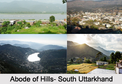
 Districts of South Uttarakhand consist of several districts like Udham Singh Nagar district, Nainital district and Champawat district.
Uttarakhand has a total geographic area of 53,483 square kilometers, of which 86 percent is mountainous and 65 percent is covered by forest. Most of the northern parts of the state are part of Greater Himalayan Mountain Range, covered by the high Himalayan peaks and glaciers. The southern part of Uttarakhand lies on the south slope of the Himalayan Mountain Range, and the climate and vegetation vary greatly with elevation, from glaciers at the highest elevations to tropical forests at the lower elevations. The highest elevations of South Uttarakhand are covered by ice and bare rock. Mount Nanda Devi is the highest peak of Uttarakhand with the altitude of 7816 m above sea level.
Udham Singh Nagar District
Udham Singh Nagar district is a district of Uttarakhand. Rudrapur is the district headquarters. Udham Singh Nagar district consists of seven Tehsils named Bajpur, Gadarpur, Jaspur, Kashipur, Kichha, Khatima, Sitarganj. Udham Singh Nagar district is located in the Terai region, and is part of Kumaon Division. Udham Singh Nagar district is bounded on the north by Nainital District, on the northeast by Champawat District, on the east by Nepal, and on the south and west by Uttar Pradesh.
Nainital District
Nainital District is a district of Uttarakhand. The headquarters is at Nainital. Nainital District is located in Kumaon Division. The Udham Singh Nagar District bound it on the north by the Almora District and on the south. Haldwani is the largest town in the district.
Champawat District
Champawat district is a district of Uttarakhand. The town of Champawat is the administrative headquarters. Champawat district constituted in the year 1997. Champawat district is divided into five tehsils like Barakot, Champawat, Lohaghat, Pati, Purnagiri. Champawat district is part of the eastern Kumaon division of Uttarakhand. It is bounded on the north by Pithoragarh district, on the east by Nepal, on the south by Udham Singh Nagar district, on the west by Nainital district, and on the northwest by Almora district.









