 Bela Pratapgarh is a city situated in the Pratapgarh District of Uttar Pradesh in India. The administrative headquarters of the Pratapgarh District are located in this city. The district is a part of the Allahabad division. The exact location of the Pratapgarh district is between 25°34` and 26° 11` latitudes and between 81°19` and 82°27` longitudes.
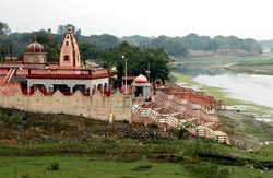
The name of the district is derived from its headquarters. Pratap Singh, a local king who ruled during 1628 to 1682, made the town of Rampur his headquarters. There he erected a fortress and called it Pratabgarh in keeping with his own name. As a sequel, the region around the fort came to be known as Pratapgarh. When the district was formed in 1858 its headquarters was set up at Bela, which later became Bela Pratapgarh, probably because of the temple of Bela Bhawani on the bank of the river Sai. The temple is generally known among the local people as "Bela Mai" - which means mother goddess bela
The district is surrounded on the north by district Sultanpur, on the south by the district Allahabad, on the east by the district of Jaunpur and on the west by the Fatehpur and on the north-east by the district of Rae Bareli. In the southwest the Ganga runs along the district for about 50 km while in the extreme northeast the Gomti constitutes the boundary for about 6 km. The district spreads over a total area of 3,730 sq. km. It is at a height of 137 m above sea level.
Like the entire district, the city of Bela Pratapgarh is renowned for "Amla" - a citrus fruit rich in Vitamin-C. The main occupation of the people is agriculture. Archaeologists have come across numerous human skeletons, some animal bones as well as a number of small stone equipments, in the area. They are presumed to belong to the Neolithic period. The region also has a "Kot" corresponding to a Buddhist Stupa. This makes many believe that there was a prehistoric Buddhist monastery in the town.